Monthly Archives: September 2013

Testing the shortcut bm271-272

On 1-9-2013 I returned to the desolated borderpass of Col d’Anaye. My goal: trying the waymarked trail up the steep hillside towards bm271. See this post about how I heard about it.
Surpringly I found the climb up more difficult than the descent. But in fact it’s not that difficult. It contains some steep and slippery parts but if you take your time and take care, you will manage. There’s enough solid rock to hold on to as support. There’s only one tougher passage through a steep gully with a tricky breach in its middle. See further on.

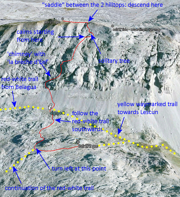
Let’s first show my route from bm271 to 272 on this overview:
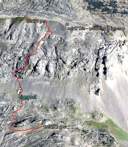


A bit to the N of the signpost, a trail (with cairns) takes you up to the steep rockwall. And then you are guided up the hillside by cairns. Much higher, the cairns disappeared but then the ridge of bm271 and 271bis (with the saddle between them) is already visible. A solitary tree a bit higher is a useful waymark when you descend from the saddle.
The elevation is ± 300m from signpost to bm271 and the climb will take ± 1 hour, same for the descent.

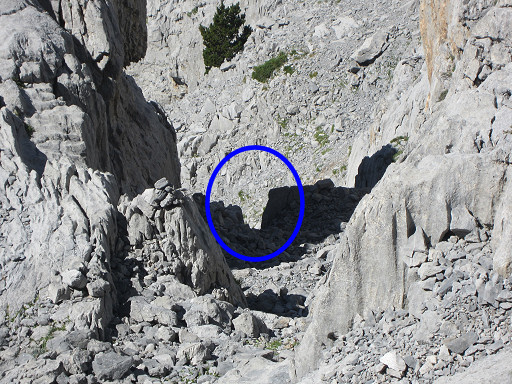
As said before, there’s one steep and slippery gully (a ‘chimney’) which requires more caution. In the middle, there’s a sort of breach to tackle. You shouldn’t be too fat to climb/descend through it. But again: descending through it was easier than I expected when I climbed up.
I propose to call it “la brèche d’Eef”, a modest but everlasting testimony of my dwellings through the Pyrenees. On this picture: the gully with its breach, seen from above
And now my proposed route from bm271 to 272 more in detail with some directions how to descend to the signpost at the foot of hillside. And how to continue to bm272 (a 20 minutes-walk).
Want to see this shortcut on Google Earth? Click on this file.
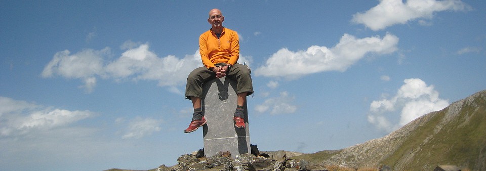
Bm271bis: a nightmare

Well, it’s a nightmare for Jesús Murueta. He has ‘done’ the esfr-bordermarkers 1-272 in the years 2000-2003, finding all these bordermarkers or getting an old picture of the few markers which are are lost. See this post for his story and to download his extensive account.

There’s one exception: bm271bis. It was a bordercross on the isolated and rough ridge of Añelarra near Pic d’Anie.  It has long been reported (on the French topographic maps) as being destroyed and no one in the last decennia has found any trace of it and we have NO old pictures. This keeps haunting  Jesus Murueta: a picture would fulfill his bordermarker-quest. Who can help him?

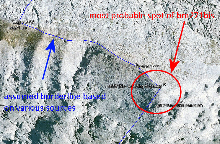
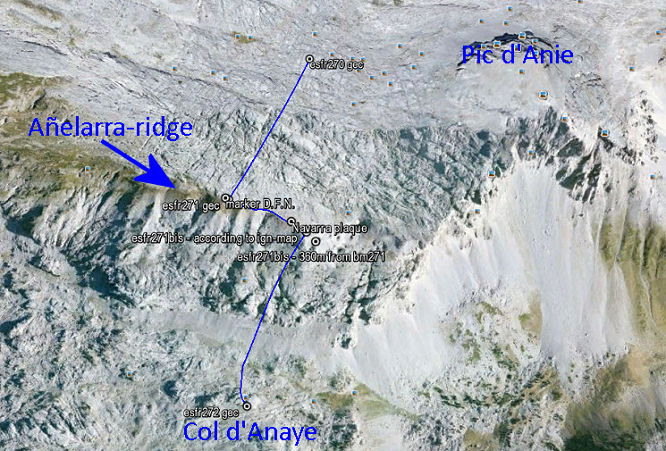
But there’s an important question: what was in fact the location of bm271bis? The esfr-border follows in this part of the karst-plateau a a zigzag-line with a straight part on the Añelarra-ridge for a few hundred meters.Let’s show it on this Google-Earth map:

The Añelarra-ridge has two summits. Bm271 is at the western summit and nowadays we find a geodesic  marker of Navarra, close to it (with D.F.N. on it = Diputación Foral de Navarra). That makes sense. The second summit is at ± 240m to the east and could make a logical location for bm271bis. Here we find today an iron plaque with the contour of Navarra and a large cairn.

But the topographical and historical evidence is different! The original treaty says that bm271bis is 360 meters from bm271 on the same ridge. But we have to acknowledge that the distances between the previous bordermarkers 262-271 – as mentioned in the treaty – are often unreliable.
The location of bm271bis on the IGN-maps is ± 310m from bm271 when following the ridge.  And that position makes more sense.  The ridge descends and bends slowly in the direction of Pic d’Anie. It’s a logical/natural place for the borderline to bend southwards and descend towards Col d’Anaye. Let’s zoom in:

I have to return and do a new search, now focussed on the lower half of the red circle. The upper half and center of the circle, I searched thoroughly on this trip.

I did them all!

Today – in the Basque country – I ‘did’ the last two bordermarkers of the Pyrenees, still to be photographed by me. We are talking about those bordermarkers which – to our knowledge – still exist. Some bordermarkers – as you know – have disappeared or are destroyed, like bm255 and 271bis.

I didn’t know these last two bordermarkers until last week. Charles Darrieu told me about them and provided pictures. So I extended my trip to the Basque country to complete this very quest of mine. They are double or extra bordermarkers of existing ones. By the way: in the last two weeks I also photographed bm330, bm310bis and bm251-cross, three other missing (by me) bordermarkers.

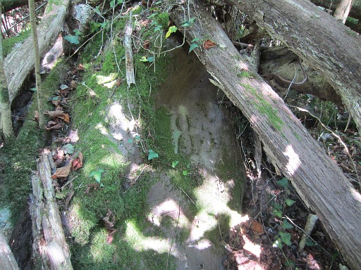
One of today’s markers is an extra number 85 on a rock, some 10 meters from the pillar 85, hidden under fallen trees. It’s mentioned in Javier Martínez Ruiz’ comprehensive article.

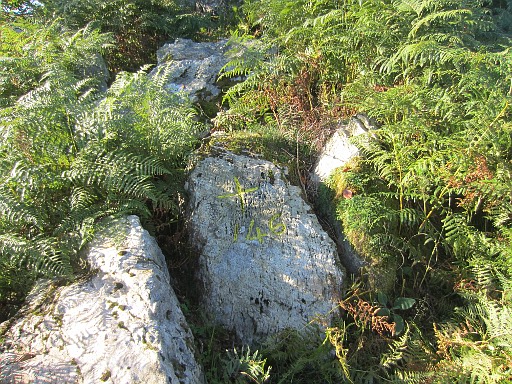
The other one is a second nr 146 + cross, close to the pillar 146. Another nr 146 + cross is to be found at the other side of the pillar, that one I did in the spring.