In the last weeks Michel Molia (from http://michelmolia.pagesperso-orange.fr/) has done a lot to find the missing submarkers 408III and IV. Without result but by doing so he could eliminate possible locations and narrowing down the terrain for future searches.
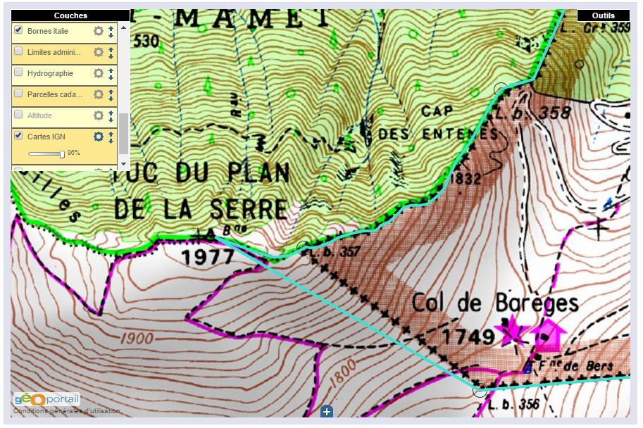
The submarkers 408-I to IV were placed in the 1960-ies in a change of the borderline to settle a borderdispute. The numbers III and IV are however unfindable. See this page for background-information.
But Michel is not the only one who has searched the area. Charles and Josette Darrieux undertook tough climbs from the Garonne up to the mountainridge and I myself did a couple of trips in the upper part.
Together we have crossed a large part of the area. Let’s put our gps-tracks together and see what’s left. You can check these tracks on a dynamic map.
 In red: Michel’s tracks in the last weeks. In yellow some of my trips and in blue the tracks of the Darrieux. The orientation: up = west
 Let’s first zoom in to the lower part where two streams (Ruisseau du Terme and la Goute de Réchèt come together for their final part to the Garonne. This could have been a possible spot for bm408-IV but Michel had already concluded that this is very unlikely considering the steepness of the terrain.
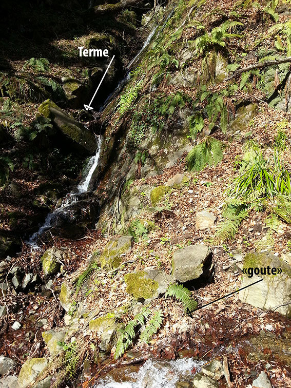
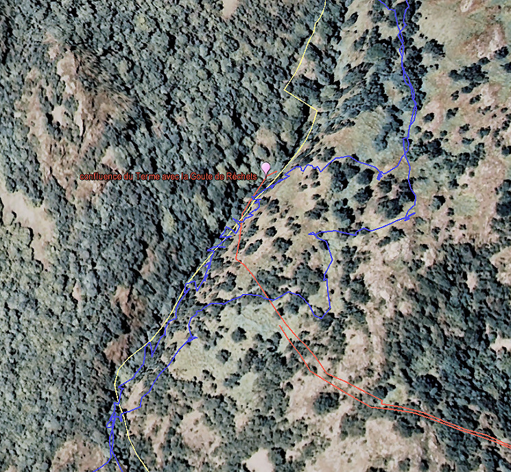
Picture of Michel of the confluence of the two streams. They are small streams as you can see.
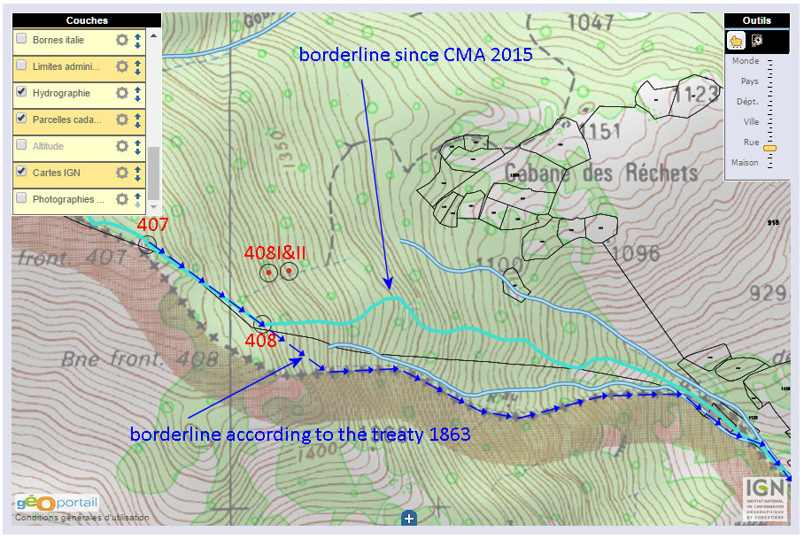
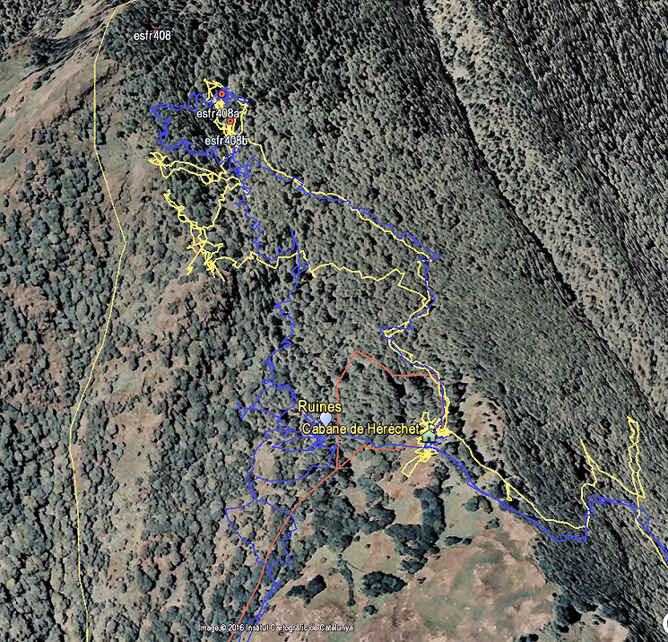 This is the upper part with possible locations not far from the Cabane de Hérechet where streams (re)appear and merge.
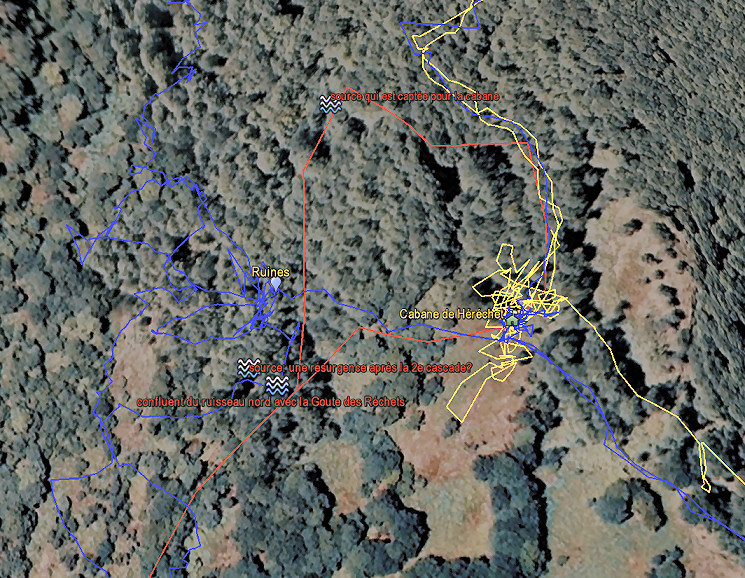 Zoom-in of the middle part. There are two streams: one which originates above the cabane (it draws its water from) and one which starts to the left of the cabane. Michel supposes that this second one could be the continuation of the stream which springs at bm408-I and supposedly goes underground to reappear here. Hij would like to test that with color-marker like Norbert Casteret did to establish the source of the Garonne.
They merge here into the Gout de Hérechet. Might have been a logical place for a submarker. However: no bordermarker around here.
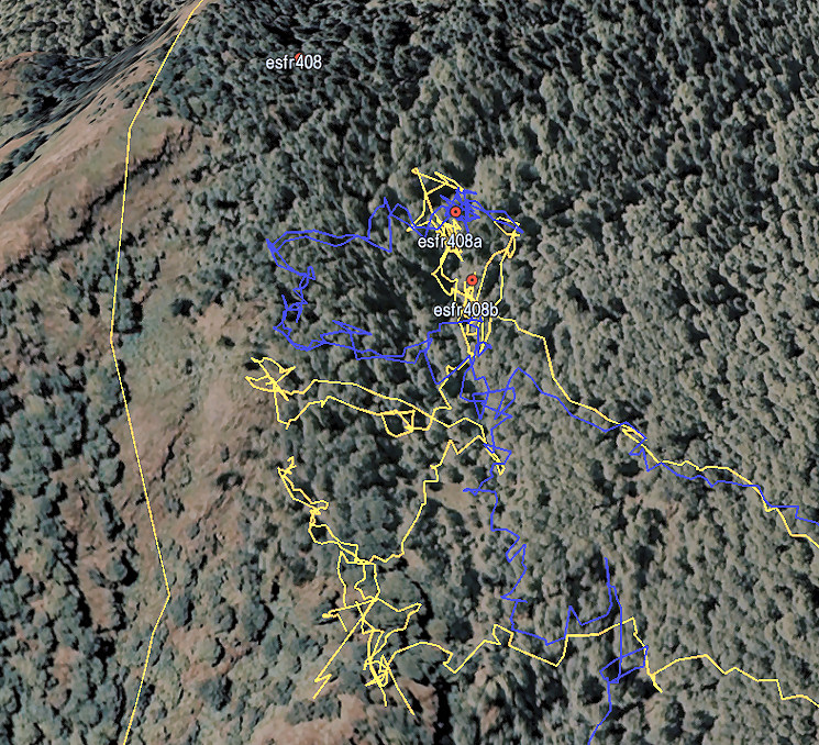 To finish: the upper part. My own theory focusses on this area but as you can see, it has been searched quite thoroughly. It remains a mystery.