Tag Archives: Jean-Paul Laborie

The Bidaubus-dispute : an update

What is the Bidaubus-dispute?

We are talking about the esfr-borderline between bm407 and 409, not far from Bagnères-de-Luchon. The dispute has been described in full detail on earlier webpages and blogposts. A starting point could be this post from 2018 and this video:

The different views on the borderline between bm407 and 409 : a summary

The borderline was described precisely in the Bayonne-treaty of 1862-1863. Let’s show that course on a map (the blue borderline is not contested).

But in the 1960-ies, the tresspassing of French territory by a Spanish logging company led to a new discussion. Central question: where is the ‘Ruisseau du Terme’? Is it the northern stream or the southern one? In the end a new borderline was agreed upon in the binational ‘Commission des Pyrénées’ and 4 intermediate markers were installed.
Since this was agreed upon bilaterally in their meeting of 1970, this borderline should be considered as the official current borderline. But in fact – as far as we know – nothing changed in the field and in the use of the terrain by French locals. On a map this 1970-version:

However: in 2015, as a result of a joint digital measurement of the esfr-borderline, a sort of diplomatic solution was proposed in the Commission Mixte d’Abornement (CMA) of 2015. Resulting in a borderline which has lost any connection with the Treaty-text. Don’t forget: it’s still a proposal, lacking an official binational approval.
But surprisingly, this new borderline is already implemented on the maps.

Who is involved in this dispute?

From our side it’s Michel Molia, myself and since 2023 Joël Molinier (a retired professor on European Law). We think that the borderline of 1862 is very well described in the treaty-text and leaves little to zero room for confusion. And thus we believe that the 1970-change and the proposal of 2015 violate the treaty, both leading to territorial losses for France.

The originator of the 2015-proposal seems to be Pierre Vergez of the French CNIG/ING who was very defensive to us about his solution. He waved with convincing Spanish counter-arguments but never disclosed them. It has been silent from his side since a few years and in these proceedings, we read that he retired in 2023. And then there is Jean-Paul Laborie – the border-commissioner in this area – who is following the official point of view from a sideline.

On a local administrative level, the mayors of Bausen (Spain) and Fos (France) have an interest in the dispute. Especially the municipality of Fos should be concerned: they are in danger of losing ± 8 hectares of their territory.

2023: The dispute presented for arbitration on a European level

This is an initiative of Joël Molinier. Within the European Union there is the institution ‘European Regional Development Fund’ which has a department (B-solutions) which aims at “solving cross-border obstacles”.
The matter has been presented to B-Solutions in june 2023 with the approval of the mayor of Fos. Further communication will be to the mayor and so far there has been no news.

2024: The “Terrain indivis de Bidaubus” better assessed

There is circumstantial evidence for our point of view in the description of the adjacent ‘terrain indivis de Bidaoubous’. It’s a strip of Spanish territory “more or less parallel to the Ruisseau du Terme” according to the treay. It kept a common right of use for both Bausen and Fos in the 1862-treaty.
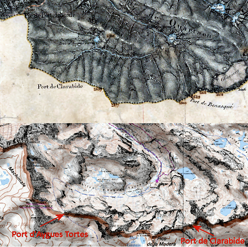
Its southern limit – including 4 engraved crosses A to D on ‘Mails’ (rocky outcrops) – was approximately estimated on the following map. The toponyms of the ‘Mails’ cannot be found back on any map. Thus the intermediate distances and natural characteristics of the terrain were used to determine the supposed spots of crosses A to D. However, none of these crosses have been found back so far.
And to be honest, this estimated version is not that parallel to the Ruisseau du Terme.

But Joël Molinier found in 2024 in 19th-century Fos-council proceedings a new clue. The shepherds of Fos complained in 1866 that they could’t reach the ridge at the level of cross B anymore, the versant being too steep there. The conclusion is that the lower cross C cannot be located at the descending hillridge. Because in that case the shepherds could still get to the ridge and up to cross B without crossing the southern ‘Terrain Indivis’-limit.
But another ‘Mail’ was found on the maps and Google Earth which fits in mentioned intermediate distances.
That led to a map in which the ‘Terrain Indivis’ is definitely more parallel to the Ruisseau de Terme than in the previous estimation. Needless to say that in a more northern interpretation of the Ruisseau du Terme, the descripton of this adjacent strip being parallel to the Ruisseau, does not fit anymore.

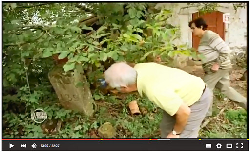
2024: The ‘Croix de Malfrenor’ still not found

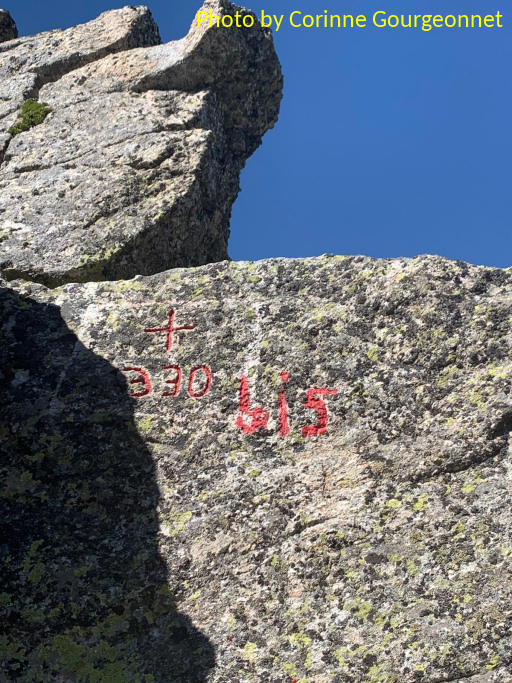
This double-branched cross was probably shown in 1959 to the border-commissioners Sermet and Alija. In a cadastral map of the 19th century it is positioned at the Ruisseau du Terme. There have been various fruitless expeditions (Michel Molia, Corinne Gourgeonnet and me) to find this cross. The significance in this discussion is however limited because the cross is not mentioned in the Treaty.

2024: Still to do

We’d love to find back the Bidaubus-crosses A to D. The presumed sites of crosses B, C and D have already been visited with no results so far. However: the presumed site of cross C has changed and that requires a new trip.
I already made a sketch of the best route if we study the maps.

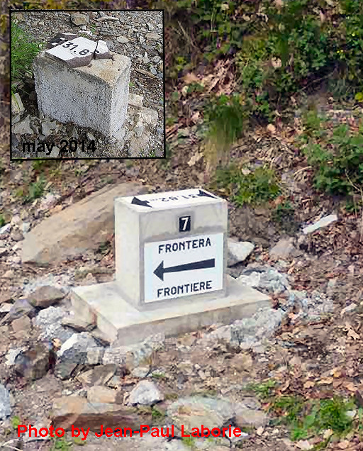
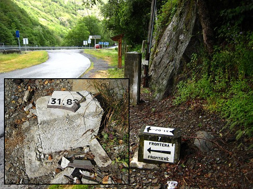
I also wonder if we can find back the remains of the original bm408, Sermet records that they were still there in the 1950-ies when a new bm408 was built. It would confirm that the new bm408 is indeed at the original position, like bm407 where the original 1862-bm is still present.

And the Croix de Malfrenor is intriguing, it must be still there.

Reasons enough to go back to that beautiful and mysterious corner of the Pyrenees and wander around to find new clues. For a part to defend our claim that the 1970- and 2015-versions are wrong. And for a larger part for the sheer fun of it.


The Bis of 330bis painted

A recent discovery of Corinne Gourgeonnet: besides the bordercross of 330(-bis) a large ‘Bis’ has been painted in recent years.

A ‘Bis’ because there are 2 crosses 330:
– one at its original location ± 4km west of this one on another border pass (engraved in the 19th century)
– and this one at Port de Clarabide, engraved in 2003. The original cross was considered to be lost or unfindable around 2000 and so a new one was engraved at Port de Clarabide.

But the original 330 still existed at the Port d’Aygues Tortes which was called Port de Clarabide on old maps. And that’s where the Treaty prescribed the engraving of bm330. But the toponyms of both passes changed on the maps in later years. And that explains the confusion.

See also this post and this webpage.

So the new 330 is in fact a second 330-bordercross and should be referred to as 330bis. That’s why the ‘Bis’ has been painted. But who is responsible for the painting? We think it is Jean-Paul Laborie – commissioner of the Pyrenean border committee – who talked about it on our joint trip to the new ADR-bordermarkers in 2019: see this post.

And indeed, it was Jean-Paul Laborie who did the job, I guess in 2020. He wrote me that he took a chisel and red paint to the Port. But his chisel proved not to be sufficient for this type of hard granite. He could only engrave the “bis” rudimentarily and paint it red. He was glad to see on Corinne’s picture that it is still in good shape. He sent me this picture with the ironical subtitle “the engraver of the peaks in his works”:


Jean-Paul Laborie again on television

Jean-Paul Laborie is a commissioner of the Pyrenean border committee. As such, he is popular with the media and has appeared several times in newspapers-articles or on television.

His latest appearance on television was part of a news-broadcast (Le 13 heures du samedi 23 mai 2020) on the French TF1-channel. Not as an actual news-item but as a human interest subject on the bordermarkers of the Pyrenees. The video contains a lot of drone-made aerial footage, I like that.

Les-bornes-frontière-de-Napoléon – Le 13 heures du samedi 23 mai 2020_TF1 from Eef Berns on Vimeo.

The video has four parts:
– part 1: Jean-Paul visits Col du Portillon (bm366) and Col de Barèges (bm356 and 358) and gives some explanations

– part 2: a trip (without Jean-Paul) to the old mines of Bentaillou which are said to be close to bm420. In fact they are much closer to bm418/419 which is still a 2-hours walk from the mines. The guide points wrongly to a col (Portillon d’Albe) where there is no bordermarker and to a mountain top (Pic de Serre Haute) with a ‘borne’ visible. But that not a ‘borne frontière’ but a giant cairn.:

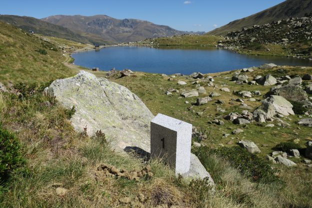
(Picture above borrowed from
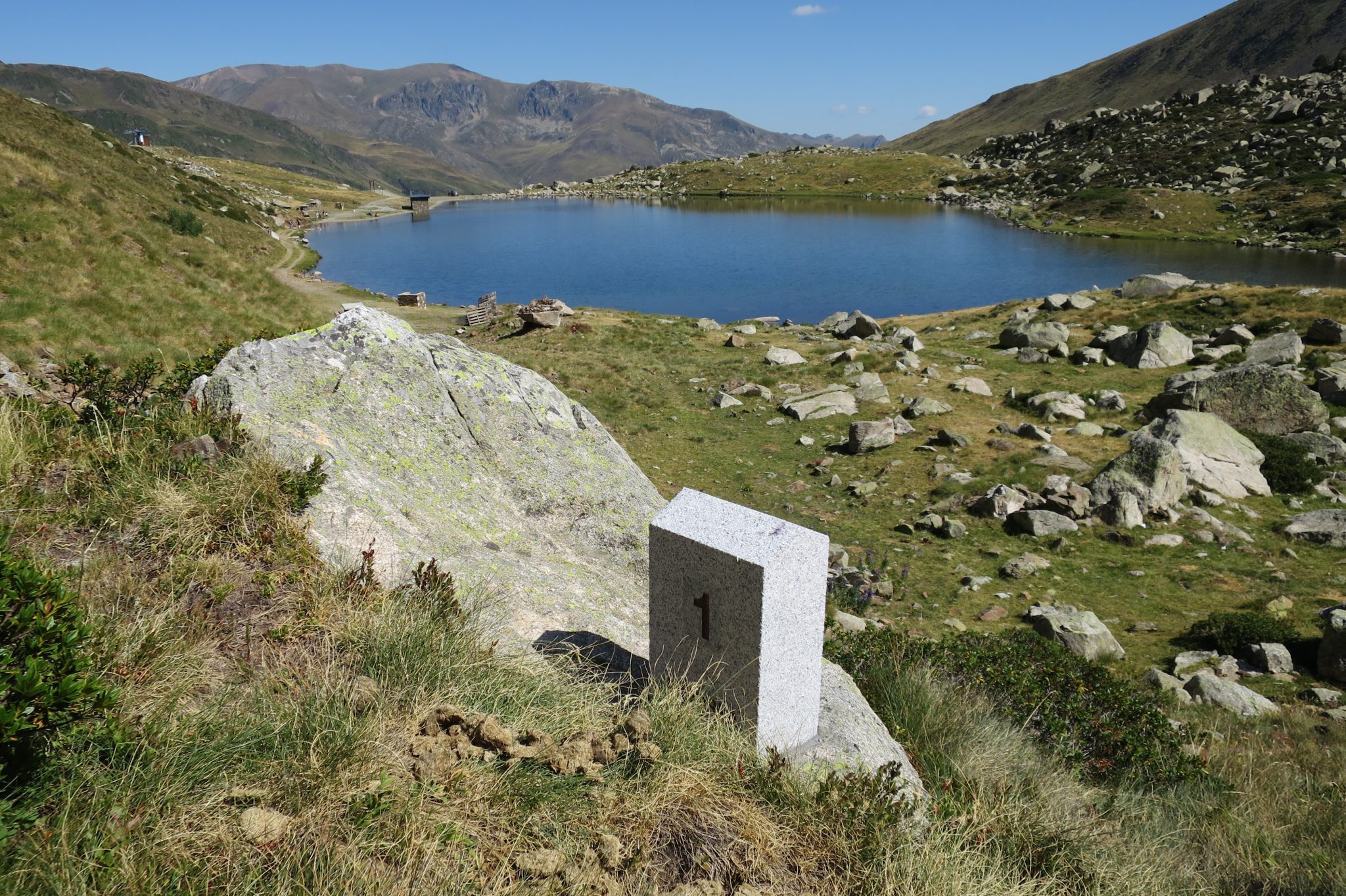
 this webpage)

– part 3: two short visits to Llivia and Le Perthus

– part 4: Jean-Paul visits for the first time bm602 which is in a cave at the mediterranean coast. Bm602 is only accessible by boat or by swimming.

The new ADFR-bordermarkers visited

Today I visited the recently installed bordermarkers between Andorra and France, see also the previous post. I checked the gps-readings as provided by the Andorra Cartography Department and they can be downloaded as a gpx or kml.

I was in a splendid company: with Corinne Gourgeonnet, Michel Molia and Jean-Paul Laborie. The last one is a member of the Pyrenean border commission and was highly involved in in the negotiations which led to the new borderline and new bordermarkers. The latest news is that the official inauguration is planned on september 6th.

Jean-Paul guided us along the new bordermarkers, telling about the choices made, his work in general and his relationship with his predecessor Jean Sermet which he admires for his writings and the esteem he had in Spain. Michel had a discussion with him on the decision on the new borderline between bm408 and 409 which he (Jean-Paul) labeled as a political compromise with little chances of reversal (see this post for my opinion on this subject). By and large, we had a very pleasant outing, crowned by a picnic provided by Corinne.


Bm409 submarker 7 restored

I was happy to receive from Jean-Paul Laborie his report of the renewal of the submarker 409-7 close to bm410 near Pont du Roi which took place a few weeks ago.

gp-esfr409g-fr-20160428-restored-photo-by-jp-laborie

The beautiful ceramic covers were destroyed between 2011 and 2014. The ceramic plates have been remade by the same company of 45 years ago. We can see that they are identical with the original ones on the next picture. The bm409-submarkers were placed in ± 1970. See this page for more information.

gp-esfr409g-fr-20090606-with-bm410-with-destroyed-bm-in-frame

Jean-Paul Laborie is a “Délégué à l’abornement”, an official border-commissioner with the assigment to check the bordermarkers in the central part of the Pyrenees. I think he has a dream-job.

Here comes Jean-Paul again

Jean-Paul Laborie is one of the border-commissioners of the Pyrenees. As such he doesn’t quite seek shelter in the shadow. Frequently he appears in newspapers or on tv. His latest appearance is in a short documentary on “Les bornes frontières entre la France et l’Espagne” telling about the bordermarkers (this is bm152) and the peculiar ‘Pays Quint’:  Spanish territory inhabited by French farmers. One thing is puzzling: at some point (at 2.05′) he seems to state that the border between two bordermarkers is a straight line which is untrue.

video-cap-sud-ouest-les bornes-frontieres

The Pays Quint is also a small subject in a longer documentary on “Les 100 lieux qu’il faut voir – Pays Basque” on France 5. In five minutes (from 30′ to 35′) bm139 is shown and the Pays Quint explained.

video-les-100-lieux-etc-pays-basque

Tv-documentary, now annotated

I have watched the documentary “Mon Pays, c’est la frontière” by Anne Fontaneau and Alexandre Gary (see previous post) several times with a lot of pleasure. It’s easy to download it using the Captvty-program.

There are 6 storylines nicely intertwined and some of them result in some sort of climax or anticlimax. These stories are:
documentary-pyrenees-2015-laborie-and-bacchus– Jean-Paul Laborie and Michel Bacchus finding bm379 and not finding bm364, Jean-Paul also engaged in repairing a unnumbered bordermarker on the new Pont du Roi near bm410. See also this post.
– A team of customs-officers chasing liquor and tobacco-smugglers coming from Andorra (a lot of manpower for small catches, I would say)
– a man fascinated by the derelict railway Pau – Canfranc (apparently it will be revived)
– a french haircutter running a hairdresser’s business in Llivia (Spanish females like colorful hair-dyes)
– about life in the “Pays Quint” with the venta above bm137 in the spotlights and a woman who has moved to this peculiar ‘binational’ territory (I think I, recognized her house)
– and a French woman delivering her baby in the first cross-border hospital of Europe: the ‘Hôpital de Cerdagne’ in Puigcerda (but with a very large majority of Spanish workers).

As you might expect, I watched with special interest the efforts of Jean-Paul Laborie and Michel Bacchus. Jean-Paul – a retired geography-professor – is an official delegate of the Pyrenean bordercommittee and Michel used to work for the IGN (French geographical institute). But I didn’t know they are “partners in crime”. That they couldn’t find bm364 didn’t surprise me, it has been searched in vain by many others.

Vandalised bordermarker to be repaired

I was happy to hear from Jean-Paul Laborie – delegate of the Pyrenean bordercommission – that the sadly destroyed submarkers 409-7fr will be replaced or repaired. The beautiful ceramic plates will be remade by the same company of 45 years ago.

gp-esfr409g-fr-20090606-with-bm410-with-destroyed-bm-in-frame
It’s one of the 2×7 submarkers between bm409 and 410 placed along the Garonne riversides and intended to mark precisely the borderline when the barrage-lake flooded the Garonne-banks around 1970. More information and pictures on this webpage

This is part of a maintenance operation at Pont du Roi where one of the unnumbered markers on the new bridge was repaired. You can read about that in this newspaper-article in which that unnumbered marker is wrongly called bm410. I liked the testimony of Laborie on the significance of maintenance of the bordermarkers: because they are our heritage!

Breaking news: bm510 replaced!

I’m happy that the lost bordercross 510 has recently been replaced by a brand new plaque. We know that the bordercross on the “Col des Neuf Croix” above Nuria was missing for many years and that a replacement was scheduled for some years already. See this webpage for my last search for it in 2010.


Jean-Paul Laborie – member of the Pyrenean bordercommittee and responsible for the Central Pyrenees – informed me on 21 october 2013 of the replacement and sent me this picture.
His two colleague-members for the eastern Pyrenees – Joan Capdevila Subirana from Girona and his French counterpart Christian Lajarrige – where the ones who took charge of the actual replacement.

Amazing: the original bm330 rediscovered

September 14, 2012. Jean-Paul Laborie climbed to Port d’Aygues Tortes in freezing weather. He had a mission: finding the original bm330. We know that this bordercross was engraved in the 19th century at Port de Clarabide and nowadays  there is still a cross 330 at this col. But that cross was engraved in 2003, the previous one was unfindable.
Jean-Paul Laborie is a member of the Pyrenean bordercommittee. Apparently bm330 puzzled him and at some point he got a brilliant idea. Could it be that the toponomy of the borderpasses as shown on the maps have changed in the course of years? And that the original Port de Clarabide was somewhere else? He compared old and contemporary maps. And his hypothesis was confirmed! The contemporary Port d’Aygues Tortes used to be Port de Clarabide. And that’s where Jean-Paul found the original bm330.