Tag Archives: bm196

Visiting bm196

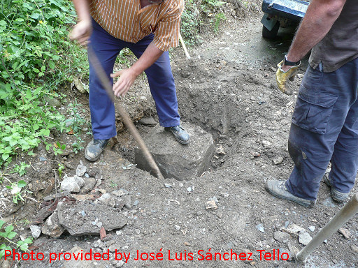
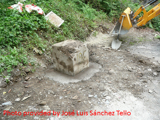
This year – on my usual september-trip to the Pyrenean bordermarkers – I had no choice than to visit the recently reinstalled bm196. Last year, Jan-Willem and I excavated this bm which had been underground for 40 years. The authorities then took their responsibility and raised it from its grave a few weeks ago.

IMG_7665
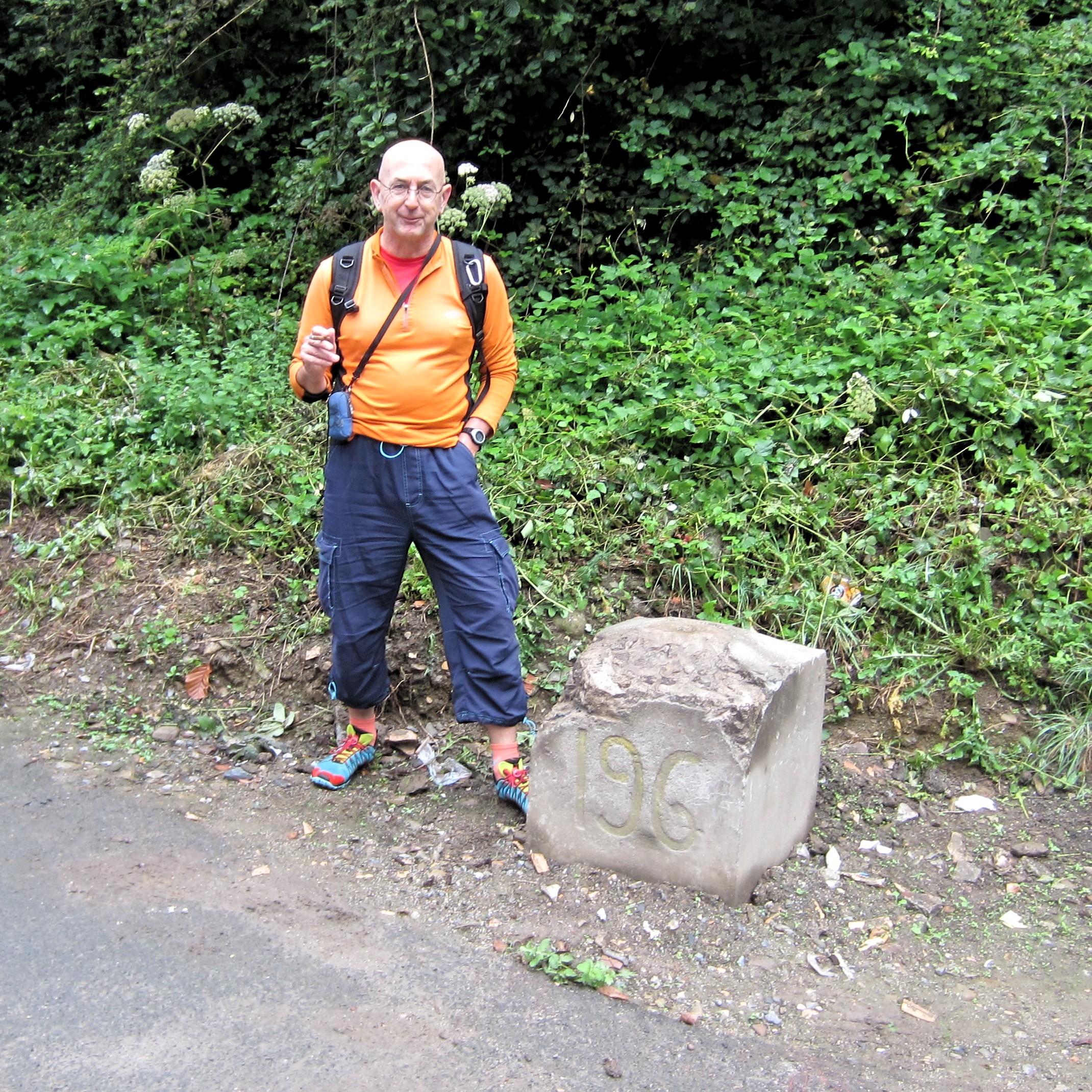
The marker makes a massive impression and the typography of the number is like some markers upon the ridge to the west. It must have been a replacement of a lost original in the ‘grand’ restauration of bordermarkers in the fifties of the 20th century.

Bm196 raised from the grave!

Yesterday – on 12 august 2014 – the 40 year buried bm196 has been raised from it’s grave. Pictures were sent to me by Captain José Luis Sánchez Tello of the Spanish Instituto Geográfico Nacional for which I’m very grateful. Read more about bm196 on this page.

gp-esfr196-20140812-photo-provided-by-tello-01

The operation took about 3 hours to complete when we examine the picture’s data.
gp-esfr196-20140812-photo-provided-by-tello-02

As you can see, the bm has been lifted half-way to appear again for every passer-by and to honour it’s significance as a cultural-historical monument as all bordermarkers are.

We thank the two delimitation delegations of Navarre and the Pyrénées Atlantiques for doing this. They have been a successful couple on more bm-restauration tasks. In this case I know that they have been reminded by bm-expert Javier Martínez Ruiz of the sad situation of bm196.

And perhaps I may suggest three other nice jobs on their common borderline: the bm236, bm255 and bm271bis


Bm196 buried again

Lucien Thomas revisited a few days ago bm196 and found that the “the poor thing” has been covered again. Bm196 has been buried for about 40 years, the last years being completely covered. In 2013 he was found again.


esfr-bm196-052014-photo-by-lucien-thomas

Lucien asks: what to do now? Well, I don’t know. Without any official involvement and reinstallment, this was bound to happen. I know that letters have been written to the municipalities on both sides of the border but nothing has happened so far.

Bm196: the ultimate evidence

I was very happy to receive – with help of Jean Hirschinger – some pictures of Anne Marie Bats and Bernadette. Those two brave women are searching the Basque bordermarkers since a year, following Jean & Simone’s example. When fleeing the Basque hills because of thunderstorms, they decided to excavate bm196 further to find a number, having their garden-tools in their car. That number still lacked as the ultimate proof that this massive block was indeed bm196. See this post.
And they succeeded! Thanks a lot, Anne Marie and Bernadette!

Jan-Willem discovers bm196

Today (31 may) was a special day: bm196 which was buried for fourty years, has been excavated by us.Together with Jan-Willem (each spring joyfully joining me on a bordermarker-trip), I undertook a last try to undig bm196. More about this engraved bordermarker on this page.

Combining once again all the available information (written, oral, satellite pictures), we could establish the most probable spot (which was 1m left to the hole I dug last year). And that’s where Jan-Willem struck and revealed the edge of this long lost bm. We couldn’t dig so deep to find a number 196 on its side (100% identification) but  I’m 99% sure this is the one and only bm196.

Why?
– its location fits within all the clues that we had
– its top resembles the ‘diamond-shape’ which Jean Sermet described
– its size (51,5 x 54cm) and material construction look very much alike many of the bm’s in the range 158-195
–  I can’t think of any other reasonable use of this object (anyway too large and lacking a hole for being the base for a gate-post).

Excavating bm196: who will finish the job?

August 25, 2012. Bm196 has been buried since ±40 years. In august 2012 I tried to excavate it. First I gave it a try at the left post of the former gate to the former meadow. One source stated that bm196 stood at the left post.
While I’m digging, a farmer passes by in his car and stops. He knows – the meadow was their property – that the bm stood at the right post of the gate and he points me that spot, say 2-2,5 meters to the right and ± 1 meter from the tarmac

Old air-picture from the SITNA-site

So I start digging at this second location. Fifteen minutes later his father passes and confirms his son’s story and points out the very same spot as he did. The buried bordermarker is a large square one and he shows the width with his hands: 50-75 cm square. And that is accordance with Jean Sermet’s account.
But digging here is tough because of stones and the dense, pressed soil. It became more difficult as I got deeper which is stil not quite deep. I gave up after 2 hours, Better tools – e.g. a pickaxe – are needed. Who – strong and daring – will finish my job?