Tag Archives: Jacques Koleck

New website: the blog of Jacques Koleck!

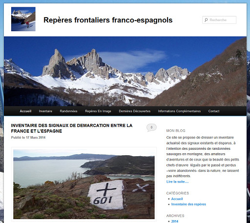
Published today, Jacques Koleck surprised me with his blog: http://jkbornesfrancoesp.over-blog.com/. I thought he still preferred handwritten letters and hardcopy photos above the digital dimension.

Jacques is one of the most industrious and thorough bordermarker-researchers I know in the Pyrenees. At the age of 71 he started with his passion and at present – after 7 years – he has covered the Pyrenees from coast to coast. He doesn’t limit himself to the obvious well-numbered bordermarkers in the 1-602 range but has an open heart for the few hundred other unnumbered bordermarkers, varying from plain intermediate crosses and borderstones until demarcation plaques in bordertunnels. The blog has started with an intriguing “inventaire etc” cq counting of all the esfr-bordermarkers in a different approach than my counting.

The very first bordermarkers

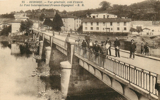
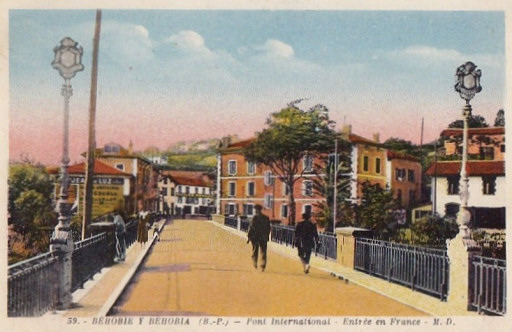
Besides the more than 700 numbered bordermarkers between France and Spain, there are many intermediate markers in all kinds of shape. The indefatigable Jacques Koleck once again found new intermediate bordermarkers in the Basque country and I’m impatiently awaiting his pictures. But thanks to him I can already show you these old postcards, found on the internet. They show the international bridge between Hendaye and Irún.
First an overview on this postcard:

What you hardly can see, are the two posts in the middle of the bridge.


But this postcard shows them very clear. They must be the two posts with both arms of Spain and France which are mentioned in article 26 of the Bayonne treaty of 1856. As such they are the very first bordermarkers mentioned in the treaty!
Jacques adds: “they have disappeared on the renewed bridge (which however has plaques with the ancient province-names) but similar posts can now be seen on the pedestrian bridge next to it.”

Ancient bordermarker decaptivated

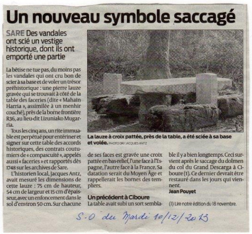
In automn last year I got this message from Lucien Thomas: the mediaval bordermarker besides bm036 has disappeared. That is to say: it was simply (and shamelessly) sawn from its base. See this article from the “Journal Sud-Ouest”:

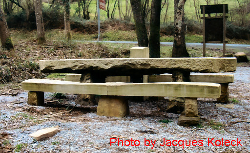
Jacques Koleck sent me a picture of the current situation:

We can see what’s left over: the base. What also strikes: the famous table (see this webpage) has received an upgrade. The wooden logs have been replaced by stone banks which much have been done in 2011/2012.

A cemetery of bordermarkers

Jacques Koleck makes me jealous: he reported another amazing discovery. At Col the Gorrospil and just beneath it, there are two fairly new bordermarkers: bm075 and 076: see this page.
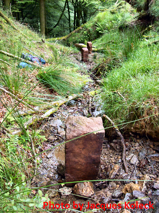
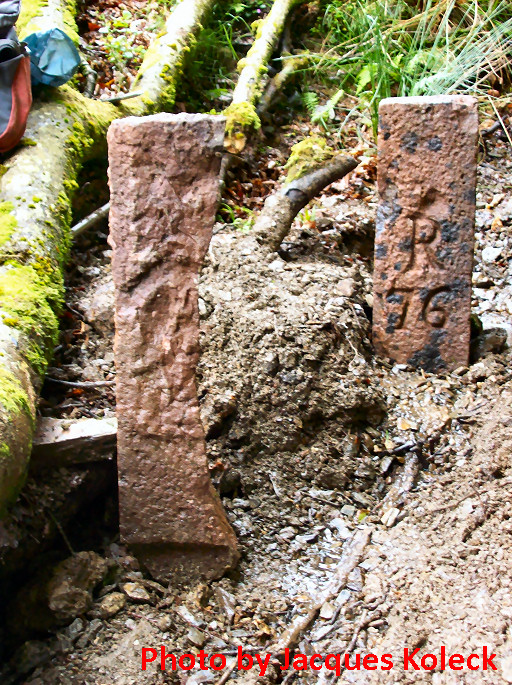
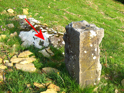
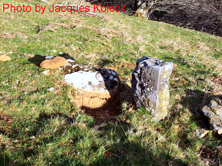
On june 30th 2013, Jaques Koleck discovered ± 50 meters downhill from bm075 the former pillars 076 and (probably) 075, both buried in the gravel of the stream of Haizagerrico, next to each other. A bit higher, he found another marker with no signs of engraving, possibly a submarker.

In more detail:
– bm076: the engraving is still fine
– bm075 (?): this one is cut vertically in half and the engraving seems destroyed with a hammer
– the third one lies 10 meters higher in line of the streambed in the open air. Jacques supposes that this is a submarker between the source of the stream (which is the borderline until Dantxarinea, 5 km to the west) and (the new) bm075.

From above from bm075, the spot of this cemetery is easy to see according to Jacques: where a huge uprooted beech tree lies flat. These old markers were put erect by Jacques to make the pictures.
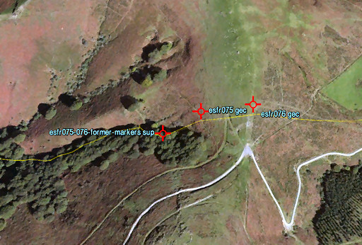
And finally, let’s project the spot of these former markers on Google Earth:

There’s something strange about bm261

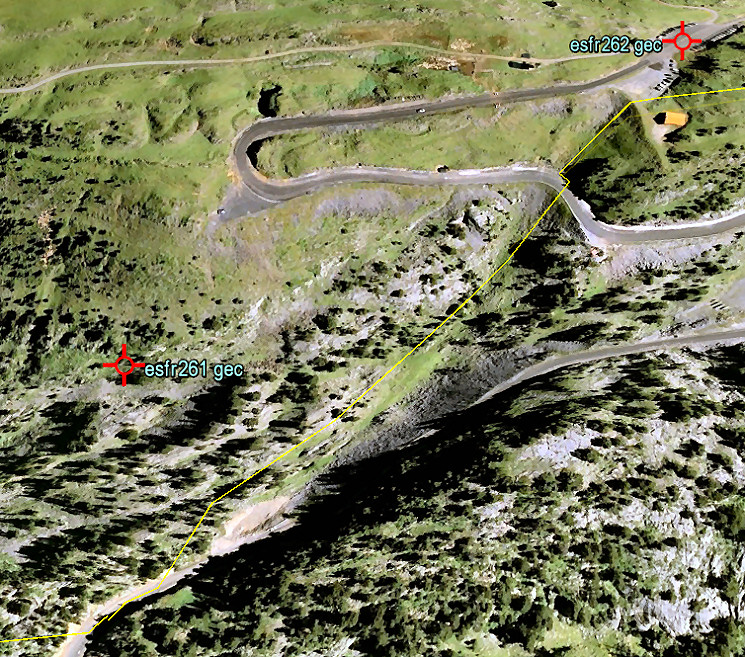
It’s location is approximately 125m west of the borderline. Why? What went wrong in 1858 or 1859? Let’s first get a bird’s-eye view.

This is a screenprint from Google Earth. The yellow line is – approximately – the borderline as we find it on the French and Spanish maps. We have a confirmation of it actual position in this terrain by a newspaper-article which states that the site of the Marcel Loubens-cave was on the borderline but the entrance of the cave a few meters on French soil. Marcel Loubens was a famous French speleologist who died in 1952 in this cave: see this wikipedia article and my own esfr-html-trips-20100907.html

So the location of bm261 is a mystery but Jacques Koleck unshrouded some of its secrets by studying the archives. He wrote me in 2013: “The 261 cross surprises a little by his position slightly to the west. In the minutes of the “Commissions de vérification des bornes internationales” – which I found in the Archives Départementales of Pau – indicate that the location of the cross 261 was verified in 1859 – eight months after the signing of the Treaty – by delegates of the communities of Saint Engrace and Isaba and from 1862 onwards by the delegates of Aramits and Isaba who found “that all bordermarkers were in good condition and placed at the places indicated in the minutes of the demarcation of december 28, 1858.”
During the period 1862-1881 the bordermarker 261 however was each year subject to a protest from the town of Saint Engrace who felt that this bordermarker was on their territory. Then everything calmed down and the Aramits- and Isaba-representatives  continued to meet every august 21 from 1911 to 1925 (later archives burned) coming to the same conclusion: “The bordermarkers are placed … on the places indicated in the minutes of the demarcation …. “.
But I still wonder about the meaning of the term “mobile bordermarker” that I found in the minutes of the Commission (1914, 1921 and 1923): “The delegates agreed that bordermarker 261, the only mobile bordermarker, is in good condition and at its original place … “. A bordermarkers is meant to be fixed and not to be mobile or to be move.

By the way, bm261 is not the only esfr-bordermarker quite dislocated from the borderline. Another example is bm235: see http://www.grpdesbf.nl/esfr-html-markers-230-236.html

Cross 145 ‘raised from the grave’ by Jacques Koleck

Jacques Koleck (see this previous post) makes me jealous: he lives close to the Pyrenees, is retired but still physically fit and has plenty of time to search for esfr-bordermarkers. His latest discovery: the original bm145!
We know bm145 as an atypical borderstone with its number vertically engraved.


Thanks to Robert Darrieumerlou, I learned that there’s a cross engraved in the rock at its foot. See this webpage on my website. Apparently – I thought – an older delimitation-cross from a pre-numbering-era. But: ‘the Treaty’ stated that bm145 was a bordercross.
Jacques got the brillant idea to undig that rock and discovered an engraved number on it:So this rock is the original bm145!!! For Jacques, this discovery was understandably “un très grand plaisir “.

Does bordercross 251 still exist?

Jacques Koleck (see previous post) surprised me by his pictures of bordercross 251, taken in 2008. We know that in the 19th century a cross 251 was engraved but – being replaced by the current borderstone 251 – I assumed that this cross was lost. Charles and Josette Darrieu searched for it but couldn’t find it. See this page on my website.

But Jacques shows that it still existed in 2008 and Charles Darrieu sent a picture of Javier Sancho, dating from june 2012. And I will gladly return to make my own pictures. But where is this cross located? Comparing the various pictures with Google Earth and my own footage results in a most likely spot. But first the pictures of Jacques:
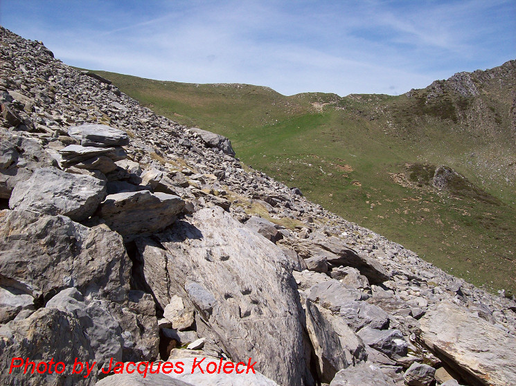
We’re looking to the west to the Port de Belhay where bm250 is located. Note the small darkgreen hilltop to the right which is visible at Google Earth. That makes it easy to determine a straight line (approx. west-east) from Port de Belhay to this cross somewhere in the rockslide.
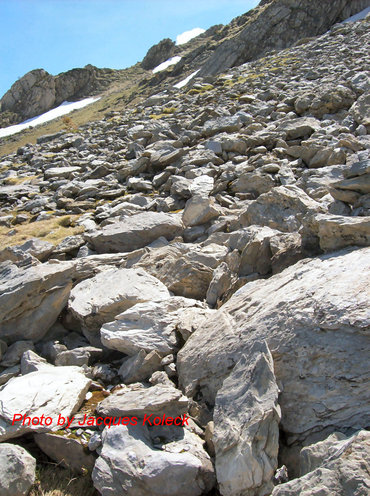
And on this second picture, we are necessarily looking south-east because of the other angle we see the cross but the picture gives no other clue. But the picture Charles sent me, made it possible to draw another line. And where those two lines intersect ……

But first an overview from Google Earth (note: compass direction reversed -> South is up). Remarkable: the yellow borderline (according to GE) is south of the actual bm251. A question for later: where is the official border?
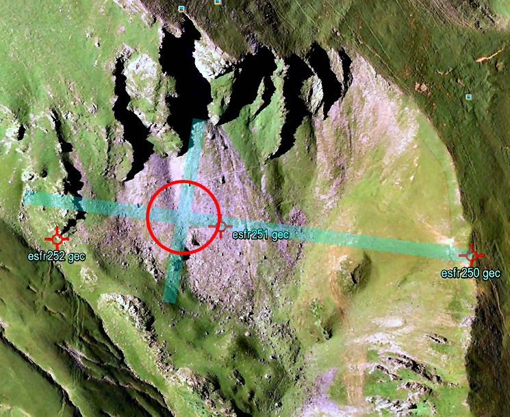
As said before, the crossing of the two straight lines should be the spot of cross 251. According to Google Earth it’s ± 50m to the SE (which is “NW” on this picture) of bm251. Jacques Koleck remembered that the cross was close to the old trail (not the red/white waymarked trail higher up) and on a “considerable” distance from bm251.
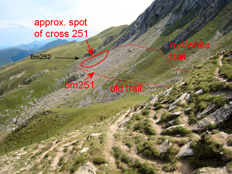
And finally an overview, as seen from Port de Belhay. Having watched this overview, Jacques Koleck added this information: “I think the cross is in the lower part of the circle, above the “old trail” and 20 meters of a large rock well visible on my photo with the Port de Belhay in the background. The cross “looks” east and is probably on a straight line between the stone marker 251 and the cross 252.” The 252-cross is just behind the lower end of the ridge, directly behind the circle.
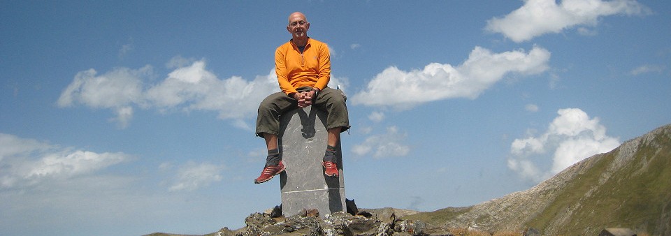
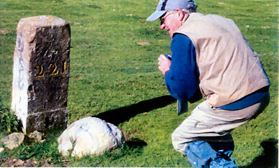
Jacques Koleck: “chasseur de bornes”, age: 77

I was happy and surprised to receive an email of Jacques Koleck, followed by many pictures and detailed information. That provides plenty of fuel for new posts on this blog.
Jacques – living in Pau – started with photographing bordermarkes in 2007. Having begun with bm001, he has now reached the eastern Pyrenees. Having expressed my hope that I can still roam the Pyrenees at his age, he told me that there is also a couple from Biarritz, both 79 years old, still walking along the bordermarkers!
Read about Jacques and his passion in this article.

(Bibliographic data:
Chasseur de bornes en Pyrénées / André-Jaques Dereix
Journal Sud Ouest – Le Mag – 15 september 2012, pag 36-37)