Tag Archives: bm271

Testing the shortcut bm271-272

On 1-9-2013 I returned to the desolated borderpass of Col d’Anaye. My goal: trying the waymarked trail up the steep hillside towards bm271. See this post about how I heard about it.
Surpringly I found the climb up more difficult than the descent. But in fact it’s not that difficult. It contains some steep and slippery parts but if you take your time and take care, you will manage. There’s enough solid rock to hold on to as support. There’s only one tougher passage through a steep gully with a tricky breach in its middle. See further on.

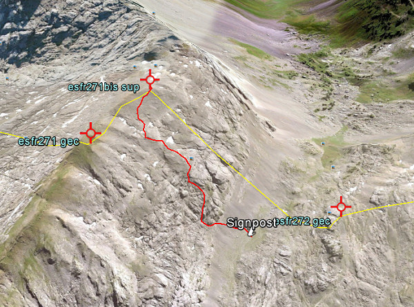
Let’s first show my route from bm271 to 272 on this overview:
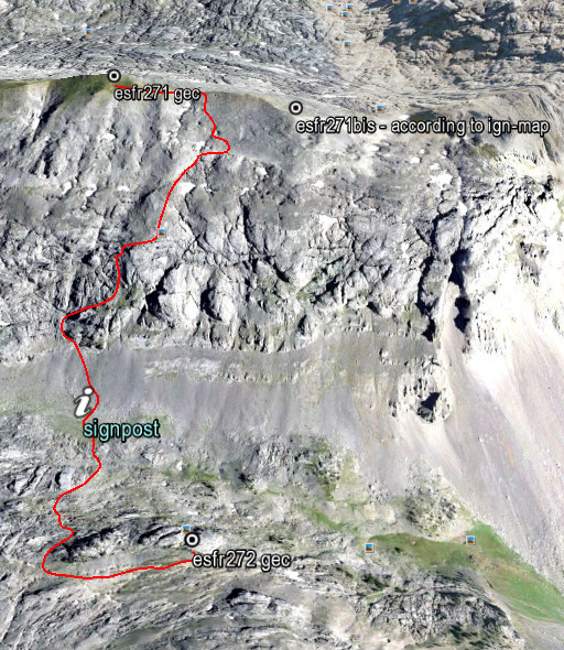


A bit to the N of the signpost, a trail (with cairns) takes you up to the steep rockwall. And then you are guided up the hillside by cairns. Much higher, the cairns disappeared but then the ridge of bm271 and 271bis (with the saddle between them) is already visible. A solitary tree a bit higher is a useful waymark when you descend from the saddle.
The elevation is ± 300m from signpost to bm271 and the climb will take ± 1 hour, same for the descent.

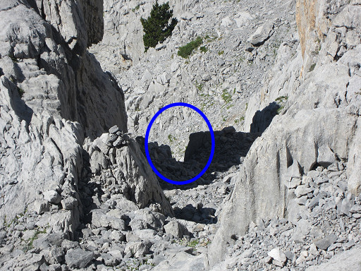
As said before, there’s one steep and slippery gully (a ‘chimney’) which requires more caution. In the middle, there’s a sort of breach to tackle. You shouldn’t be too fat to climb/descend through it. But again: descending through it was easier than I expected when I climbed up.
I propose to call it “la brèche d’Eef”, a modest but everlasting testimony of my dwellings through the Pyrenees. On this picture: the gully with its breach, seen from above
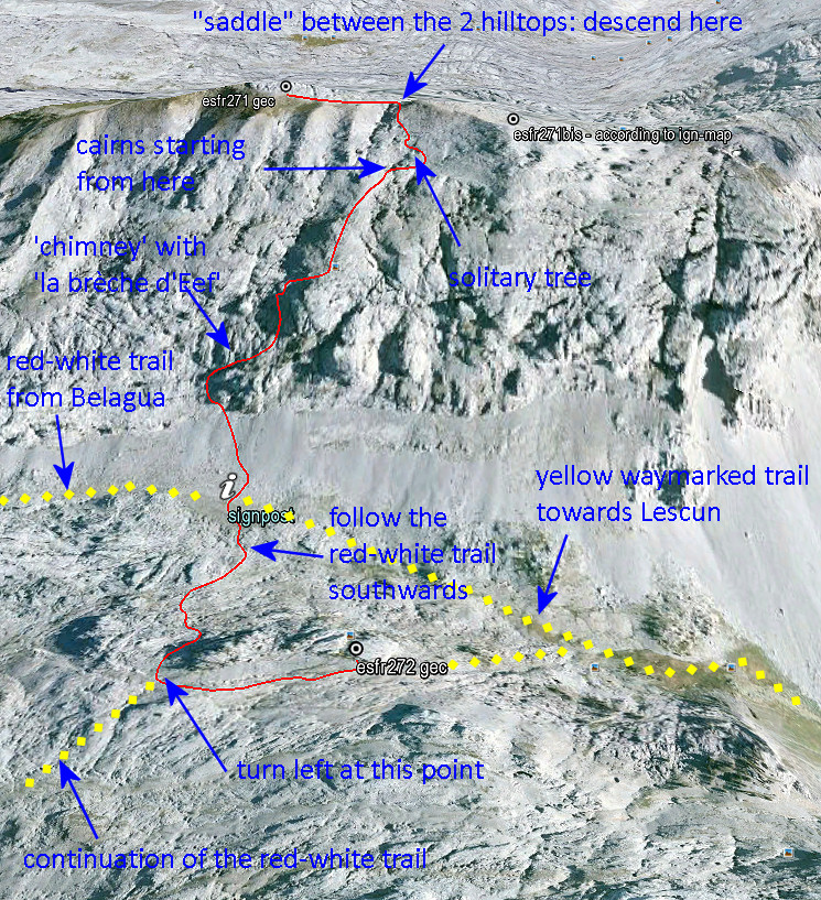
And now my proposed route from bm271 to 272 more in detail with some directions how to descend to the signpost at the foot of hillside. And how to continue to bm272 (a 20 minutes-walk).
Want to see this shortcut on Google Earth? Click on this file.
A shortcut between bm271 and 272: confirmed!

The evidence presented in the previous post has been confirmed by Charles Darrieu. He and his wife Josette tried in 2008 the first part of the shortcut, starting from Col d’Anaye. They didn’t have enough time to climb to the ridge but they found a cairn-waymarked trail uphill.
Moreover: Charles showed how on the Topopirineos-map (see next post) this trail is indicated. And moreover: on Google Earth we can even spot the beginning of it on Col d’Anaye.

I made a kml-file of this connection: esfr-bm271bis-272-connection-on-topopirineos.kml

Let’s show some pictures: first an overview of the connection on Google Earth.

And now a view towards Col d’Anaye , approximately on 3/4 of the route from uphill to the Col.

And this picture shows the very beginning, when started from Col d’Anaye. If fact it’s very simple: from the current wooden signpost at Col d’Anaye, climb straight N and soon you will pick up the trail (hito = cairn).


A shorter route between bm271 and 272?

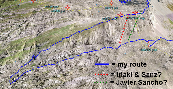
On 20120829 I had to make a large detour to get from bm271 to 272. A shorter descent seemed impossible because of the steepness of the rock-hillside underneath bm271. But I was surprised to read that Iñaki Vigor and Carlos Sanz (see literature) did use a more direct (cairns-waymarked) trail. They also thought it was far too steep. But they found at the saddle between the two hilltops (between bm271 and the former bm271bis) a cairns-trail which took  them without much problems to down below.
Also Javier et María-Jesús Sancho-Esnaola (see this previous post) took a short-cut but their starting point was the saddle east of bm297bis. They talk about following a cairns-trail, descending to the right down a gully (including some rock-scrambling), the route not always being obvious.

In both cases, they must have descended SW. Straight S is – according to the elevation lines – really too steep. Let’s draw it on this Google Earth-capture:

Conclusion: I have to return and check.