Category Archives: News 2013

The Murgoi-files

I was very happy to receive 344 individual pages (digital) by Jesús Murueta Goikoetxea, also known as ‘Murgoi’  of ‘El Canadiense’. See this post.
I made a Pdf-file of it and called it “The Murgoi-files”. You can read/download it with this link. (it’s a LARGE file: 280mb! Downloading will take time)

They are the accounts of his countless trips undertaken in the years 2000-2003 to find and photograph all the esfr-bordermarkers of the Basque country (no. 1-272). Each bordermarker has its own page and consists of handwritten and typed descriptions, directions and pictures. Part of the pictures are his, others come from other sources. Besides this, there are many maps.
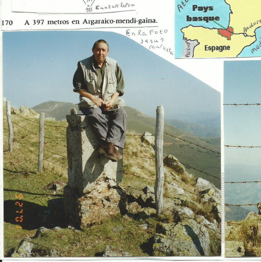

Jesús Murueta Goikoetxea is a native of Bilbao but lives since long in Canada. He returned many times to visit family & friends and to fulfill his dream: this project. Now -being in his seventies – he’s more than happy to share his collection and experiences.

NOTE: you are free to use any information and pictures in these files but always pay respect to Murgoi by referring to him as the source.
New update of “The bordermarkers of the Pyrenees”

I’m proud to announce a new update covering my last trips to the Basque country and Lliva.

And there are many more additions: check the update-log

Bm196: the ultimate evidence

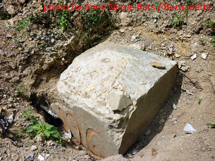
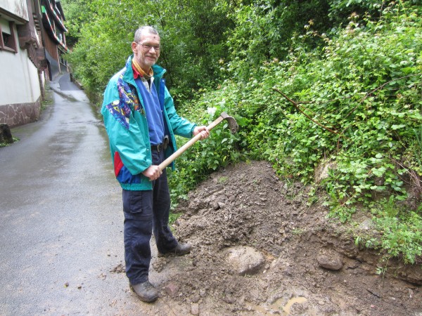
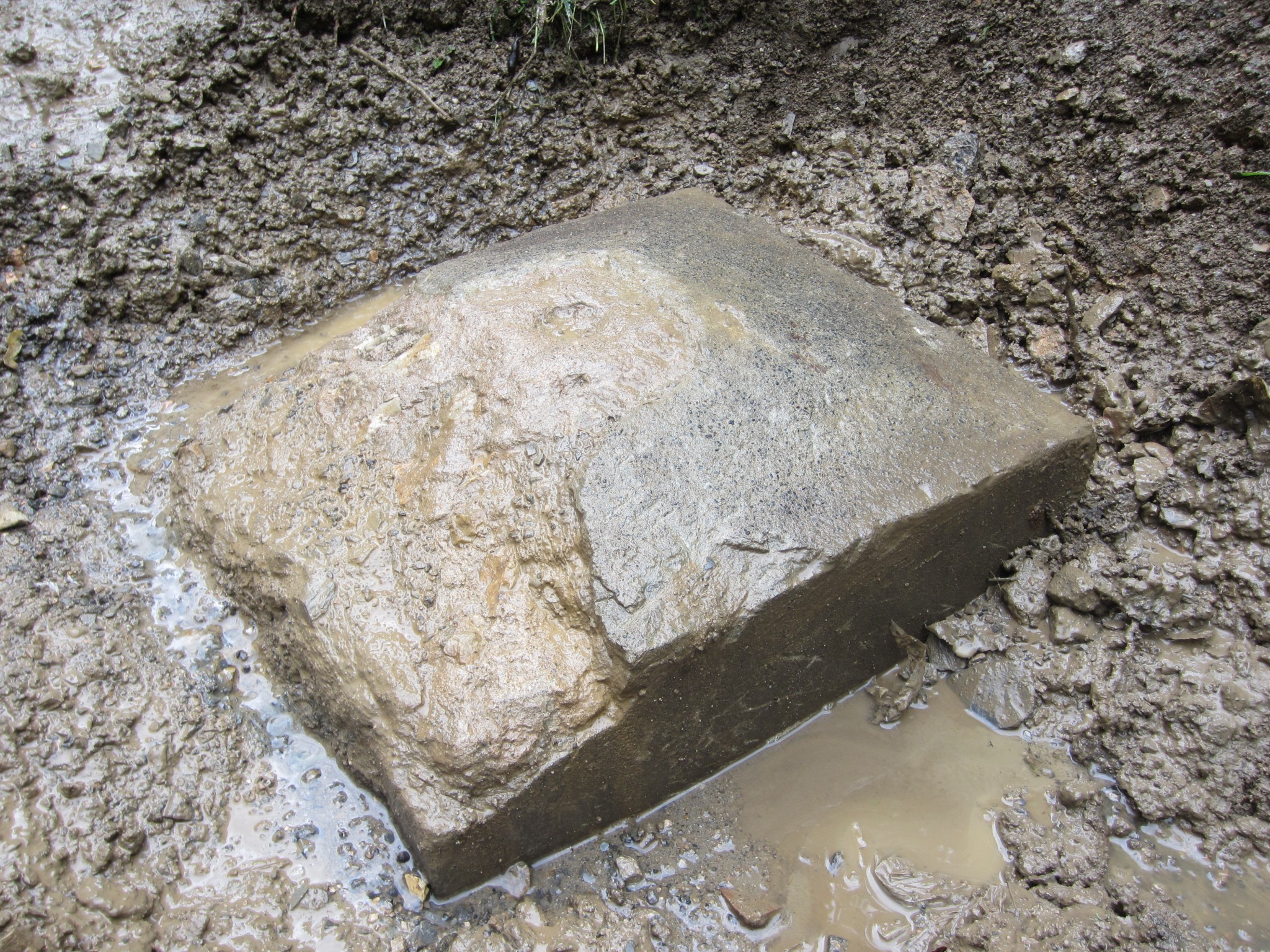
I was very happy to receive – with help of Jean Hirschinger – some pictures of Anne Marie Bats and Bernadette. Those two brave women are searching the Basque bordermarkers since a year, following Jean & Simone’s example. When fleeing the Basque hills because of thunderstorms, they decided to excavate bm196 further to find a number, having their garden-tools in their car. That number still lacked as the ultimate proof that this massive block was indeed bm196. See this post.
And they succeeded! Thanks a lot, Anne Marie and Bernadette!

A cemetery of bordermarkers – continued

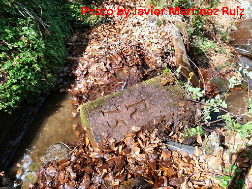
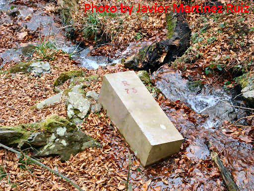
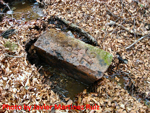
Shortly after the previous post, Javier Martínez Ruiz surprised me with the pictures of his exploration in 2007 of this cemetery of the bordermarkers 75 and 76. At that time, these abandoned borderstones were far more visible than now. And there were even two pillars 75, all bordermarkers apparently pushed down the hill by vandals.

A cemetery of bordermarkers

Jacques Koleck makes me jealous: he reported another amazing discovery. At Col the Gorrospil and just beneath it, there are two fairly new bordermarkers: bm075 and 076: see this page.
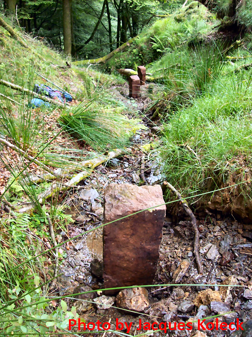
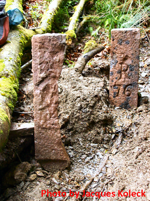
On june 30th 2013, Jaques Koleck discovered ± 50 meters downhill from bm075 the former pillars 076 and (probably) 075, both buried in the gravel of the stream of Haizagerrico, next to each other. A bit higher, he found another marker with no signs of engraving, possibly a submarker.

In more detail:
– bm076: the engraving is still fine
– bm075 (?): this one is cut vertically in half and the engraving seems destroyed with a hammer
– the third one lies 10 meters higher in line of the streambed in the open air. Jacques supposes that this is a submarker between the source of the stream (which is the borderline until Dantxarinea, 5 km to the west) and (the new) bm075.

From above from bm075, the spot of this cemetery is easy to see according to Jacques: where a huge uprooted beech tree lies flat. These old markers were put erect by Jacques to make the pictures.
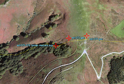
And finally, let’s project the spot of these former markers on Google Earth:

A shortcut from bm137 to bm139

On our last Pyrenees-trip, Jan-Willem and I explored the terrain between bm137 and 139. On this steep hill, a more or less direct descent via bm138 seems quite difficult. But a detour (especially between 138 & 139 as I did in 2009) requires extra kilometers on tarmac.
We found out that the descent from 137 to 138 is quite steep and rough although wayfinding is no problem and part of it is a trail. The route between 138 and 139 is more gentle and pleasant.
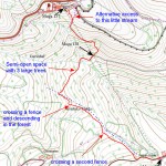
It’s all shown on this map (from the Sitna-site): click on it to enlarge.

Jan-Willem discovers bm196

Today (31 may) was a special day: bm196 which was buried for fourty years, has been excavated by us.Together with Jan-Willem (each spring joyfully joining me on a bordermarker-trip), I undertook a last try to undig bm196. More about this engraved bordermarker on this page.

Combining once again all the available information (written, oral, satellite pictures), we could establish the most probable spot (which was 1m left to the hole I dug last year). And that’s where Jan-Willem struck and revealed the edge of this long lost bm. We couldn’t dig so deep to find a number 196 on its side (100% identification) but  I’m 99% sure this is the one and only bm196.

Why?
– its location fits within all the clues that we had
– its top resembles the ‘diamond-shape’ which Jean Sermet described
– its size (51,5 x 54cm) and material construction look very much alike many of the bm’s in the range 158-195
–  I can’t think of any other reasonable use of this object (anyway too large and lacking a hole for being the base for a gate-post).

New update of “The bordermarkers of the Pyrenees”

I’m proud to announce that the second series of GRPdesBF-stages is ready: you can walk from Arnéguy to Col de la Pierre St-Martin  (bm196-262) in 4 days.

And there are many additions: check the update-log

Almost 80 and still roaming the border

I was very happy to receive a copy of

THOMAS, Lucien
Bornes frontière France/Espagne – Années 2010 – 2011 – 2012
Biarritz, 2013 (a private edition of only 40 copies)

It’s a photo-account of the bordermarkers 1 to 272 with large and clear pictures. I liked it very much. It’s the culmination of a remarkable project by a remarkable couple. Lucien Thomas was 76 years old when he started in 2010 with this adventure, together with his wife Colette.

There’s something strange about bm261

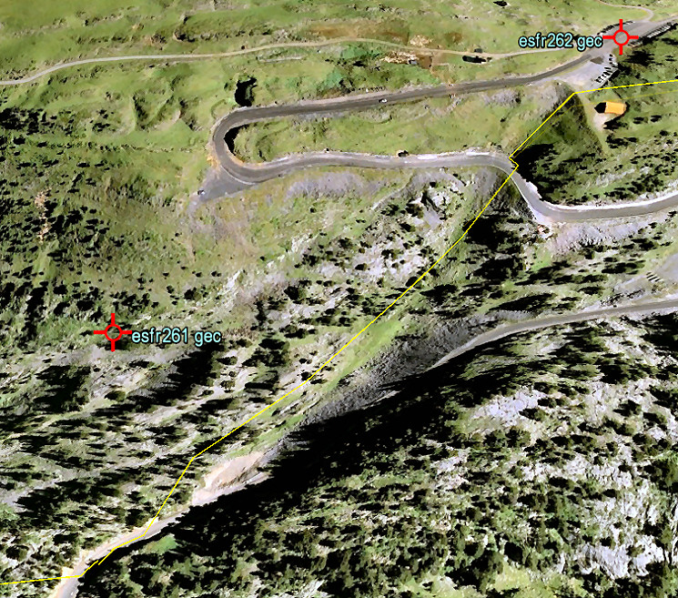
It’s location is approximately 125m west of the borderline. Why? What went wrong in 1858 or 1859? Let’s first get a bird’s-eye view.

This is a screenprint from Google Earth. The yellow line is – approximately – the borderline as we find it on the French and Spanish maps. We have a confirmation of it actual position in this terrain by a newspaper-article which states that the site of the Marcel Loubens-cave was on the borderline but the entrance of the cave a few meters on French soil. Marcel Loubens was a famous French speleologist who died in 1952 in this cave: see this wikipedia article and my own esfr-html-trips-20100907.html

So the location of bm261 is a mystery but Jacques Koleck unshrouded some of its secrets by studying the archives. He wrote me in 2013: “The 261 cross surprises a little by his position slightly to the west. In the minutes of the “Commissions de vérification des bornes internationales” – which I found in the Archives Départementales of Pau – indicate that the location of the cross 261 was verified in 1859 – eight months after the signing of the Treaty – by delegates of the communities of Saint Engrace and Isaba and from 1862 onwards by the delegates of Aramits and Isaba who found “that all bordermarkers were in good condition and placed at the places indicated in the minutes of the demarcation of december 28, 1858.”
During the period 1862-1881 the bordermarker 261 however was each year subject to a protest from the town of Saint Engrace who felt that this bordermarker was on their territory. Then everything calmed down and the Aramits- and Isaba-representatives  continued to meet every august 21 from 1911 to 1925 (later archives burned) coming to the same conclusion: “The bordermarkers are placed … on the places indicated in the minutes of the demarcation …. “.
But I still wonder about the meaning of the term “mobile bordermarker” that I found in the minutes of the Commission (1914, 1921 and 1923): “The delegates agreed that bordermarker 261, the only mobile bordermarker, is in good condition and at its original place … “. A bordermarkers is meant to be fixed and not to be mobile or to be move.

By the way, bm261 is not the only esfr-bordermarker quite dislocated from the borderline. Another example is bm235: see http://www.grpdesbf.nl/esfr-html-markers-230-236.html