Category Archives: News 2013

Jean and Simone announcing their book

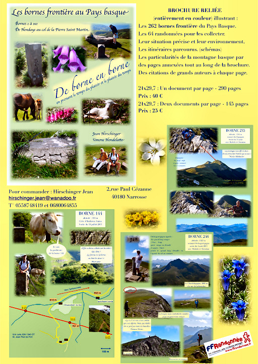
Jean Hirschinger and his partner Simone Hondelatte have since 2010 searched and photographed the bordermarkers of the Basque country: no. 1 to 262. Jean is an experienced walker and used to be the vice-president of the “Fédération Européenne de Randonnée Pédestre

They will publish their pictures and information on itineraries, maps, details in a marvellous and inspiring lay-out. I was thrilled to see the brochure of their book and immediately ordered a copy. Well, look and judge for yourself:


Click here to enlarge the brochure. Prices and how to order: it’s all in the brochure.

Gps-project in the western Pyrenees

I came across two Spanish newspaper-articles (this one and this one)  on a project in mid 2013 to establish with a gps the exact coordinates of the bordermarkers 1-272 and the borderline in between them. The same project should already have been undertaken at the Catalonian border with France (bm333-602).
As we know, the position of the borderline and bordermarkers and their representation on maps is not always clear and unambiguous. I have made my own list of Cartographic errors & omissions on this page.


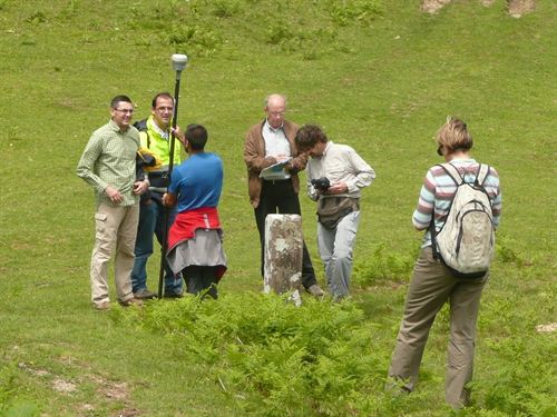
On this picture we can see how the measurement is undertaken with professional = highly accurate gps-devices. Ordinary gps-devices (like the one I use) loose their accurateness significantly in wooded and tilted places. That makes one possessive: where can I get these super-precise GPS-data? And very important: what did they do with the bordermarkers which have disappeared: bm236, 255 and 271bis?
By the way: my own coordinates of all bordermarkers are downloadable on this page.

Paint and support for bm545 and 546

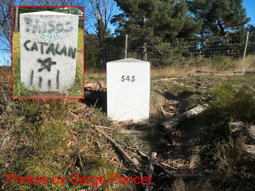
Serge Poncet sent me some pictures in november 2013 of the maintenance work on bm545 and 546. The vandalized bm545 was neatly painted over in white. Bm546 – hanging dangerously at the steep roadside – got a sturdy fundament. Bravo for honoring these historic monuments. I’m curious who are the ‘actors’ and which are the rules in this proces of surveying and deciding and implementation.


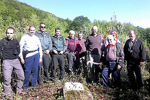
What we know is that each year a bordermarker-survey is done near Coustouges, involving the communicipalities at both side of the border. I found this picture in the newspaper “l’Independant” of 19 june 2013. Jean Iglesias is still ‘alive and kicking’ as the guide of the party.

New update of “The bordermarkers of the Pyrenees”

I’m proud to announce a new update covering my last trips to the Pyenees.

And there are many more additions: check the update-log

In a kayak to bm602

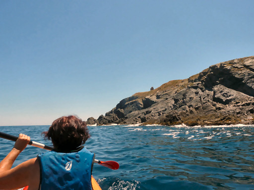
Bm602 – the last bordermarker – is hidden in a cave at the mediterranean coast and can only be visited by boat. On 21 may 2011 we hired a boat & sailor to get there and I know that Charles & Josette Darrieu did the same.
I was surprised to learn from Serge Poncet that you can also peddle in a kayak to the cave. If the sea is calm, it can be easily done, so it seems. Serge hired a 2-persons kayak from the ‘Centre de Plongée de Cerbère’ (25€ for a half day) and peddled with his wife to the cave.

Serge Poncet is since 2011 passionate about the Pyrenean bordermarkers. He has almost ‘done’ all the bordermarkers east of Andorra and will continue in the Basque country next year. He has served in the French mountain army forces and he wrote me that he is capable of long, long mountain trips. I think we can expect a lot more of him.

Breaking news: bm510 replaced!

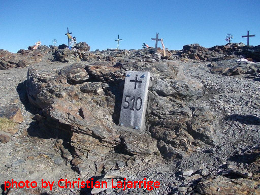
I’m happy that the lost bordercross 510 has recently been replaced by a brand new plaque. We know that the bordercross on the “Col des Neuf Croix” above Nuria was missing for many years and that a replacement was scheduled for some years already. See this webpage for my last search for it in 2010.


Jean-Paul Laborie – member of the Pyrenean bordercommittee and responsible for the Central Pyrenees – informed me on 21 october 2013 of the replacement and sent me this picture.
His two colleague-members for the eastern Pyrenees – Joan Capdevila Subirana from Girona and his French counterpart Christian Lajarrige – where the ones who took charge of the actual replacement.

Testing the shortcut bm271-272

On 1-9-2013 I returned to the desolated borderpass of Col d’Anaye. My goal: trying the waymarked trail up the steep hillside towards bm271. See this post about how I heard about it.
Surpringly I found the climb up more difficult than the descent. But in fact it’s not that difficult. It contains some steep and slippery parts but if you take your time and take care, you will manage. There’s enough solid rock to hold on to as support. There’s only one tougher passage through a steep gully with a tricky breach in its middle. See further on.

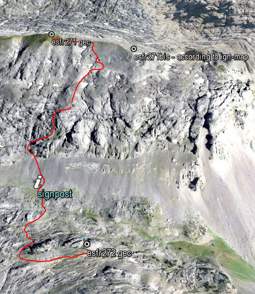
Let’s first show my route from bm271 to 272 on this overview:


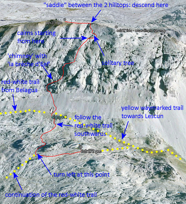
A bit to the N of the signpost, a trail (with cairns) takes you up to the steep rockwall. And then you are guided up the hillside by cairns. Much higher, the cairns disappeared but then the ridge of bm271 and 271bis (with the saddle between them) is already visible. A solitary tree a bit higher is a useful waymark when you descend from the saddle.
The elevation is ± 300m from signpost to bm271 and the climb will take ± 1 hour, same for the descent.

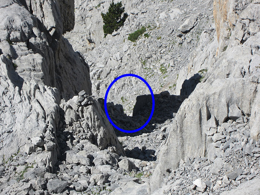
As said before, there’s one steep and slippery gully (a ‘chimney’) which requires more caution. In the middle, there’s a sort of breach to tackle. You shouldn’t be too fat to climb/descend through it. But again: descending through it was easier than I expected when I climbed up.
I propose to call it “la brèche d’Eef”, a modest but everlasting testimony of my dwellings through the Pyrenees. On this picture: the gully with its breach, seen from above

And now my proposed route from bm271 to 272 more in detail with some directions how to descend to the signpost at the foot of hillside. And how to continue to bm272 (a 20 minutes-walk).

Want to see this shortcut on Google Earth? Click on this file.

Bm271bis: a nightmare

Well, it’s a nightmare for Jesús Murueta. He has ‘done’ the esfr-bordermarkers 1-272 in the years 2000-2003, finding all these bordermarkers or getting an old picture of the few markers which are are lost. See this post for his story and to download his extensive account.

There’s one exception: bm271bis. It was a bordercross on the isolated and rough ridge of Añelarra near Pic d’Anie.  It has long been reported (on the French topographic maps) as being destroyed and no one in the last decennia has found any trace of it and we have NO old pictures. This keeps haunting  Jesus Murueta: a picture would fulfill his bordermarker-quest. Who can help him?

But there’s an important question: what was in fact the location of bm271bis? The esfr-border follows in this part of the karst-plateau a a zigzag-line with a straight part on the Añelarra-ridge for a few hundred meters.Let’s show it on this Google-Earth map:
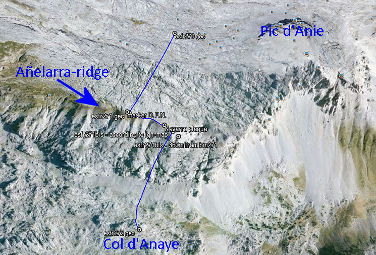
The Añelarra-ridge has two summits. Bm271 is at the western summit and nowadays we find a geodesic  marker of Navarra, close to it (with D.F.N. on it = Diputación Foral de Navarra). That makes sense. The second summit is at ± 240m to the east and could make a logical location for bm271bis. Here we find today an iron plaque with the contour of Navarra and a large cairn.

But the topographical and historical evidence is different! The original treaty says that bm271bis is 360 meters from bm271 on the same ridge. But we have to acknowledge that the distances between the previous bordermarkers 262-271 – as mentioned in the treaty – are often unreliable.
The location of bm271bis on the IGN-maps is ± 310m from bm271 when following the ridge.  And that position makes more sense.  The ridge descends and bends slowly in the direction of Pic d’Anie. It’s a logical/natural place for the borderline to bend southwards and descend towards Col d’Anaye. Let’s zoom in:
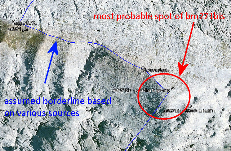
I have to return and do a new search, now focussed on the lower half of the red circle. The upper half and center of the circle, I searched thoroughly on this trip.
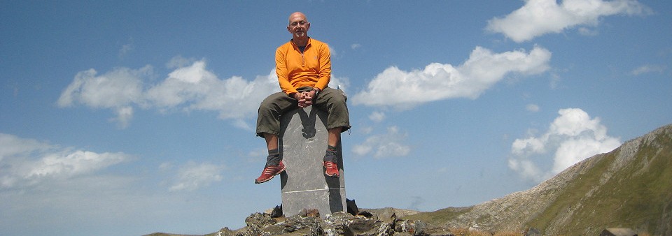
I did them all!

Today – in the Basque country – I ‘did’ the last two bordermarkers of the Pyrenees, still to be photographed by me. We are talking about those bordermarkers which – to our knowledge – still exist. Some bordermarkers – as you know – have disappeared or are destroyed, like bm255 and 271bis.

I didn’t know these last two bordermarkers until last week. Charles Darrieu told me about them and provided pictures. So I extended my trip to the Basque country to complete this very quest of mine. They are double or extra bordermarkers of existing ones. By the way: in the last two weeks I also photographed bm330, bm310bis and bm251-cross, three other missing (by me) bordermarkers.

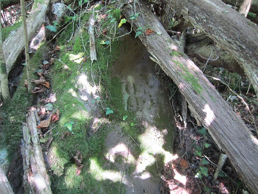
One of today’s markers is an extra number 85 on a rock, some 10 meters from the pillar 85, hidden under fallen trees. It’s mentioned in Javier Martínez Ruiz’ comprehensive article.

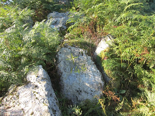
The other one is a second nr 146 + cross, close to the pillar 146. Another nr 146 + cross is to be found at the other side of the pillar, that one I did in the spring.


Le désir de détruire: bm420bis vandalised

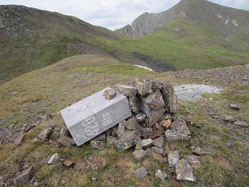
It may sound poetical in french: “le désir de détruire” but this desire to destroy precious things like bordermarkers has a new victim. On my 6-days hike along the  Ariège-borderridge from bm418 to bm425 I found on august 22th 2013 bm420bis broken in two. That must have been done since my last visit in september 2011
 Bm420bis is a new bordermarker, placed in 1997. A Spanish official had discovered that the presumed borderline in this part was wrong. The watershed is actually to the north of the basin in question. To confirm this change in demarcation, this brand new bordermarker was placed. See this webpage for more information.