
In the busy bordertown of Le Perthus, there are two very remarkable bordermarkers: 2 pillar-like markers with a coat of arms of both countries. They stand on either side of the main road from Spain to Perpignan. They date from 1764, from the Convention of Perpignan. Later on – in the 19th century – they were incorporated in the Bayonne-treaties and got their numbers in the 1-602 sequence: 574 and 575.
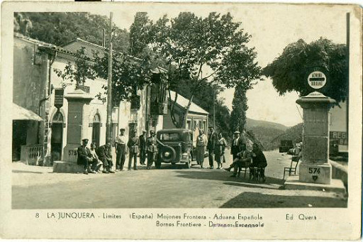
Old postcard showing them together, looking into Spain
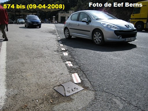
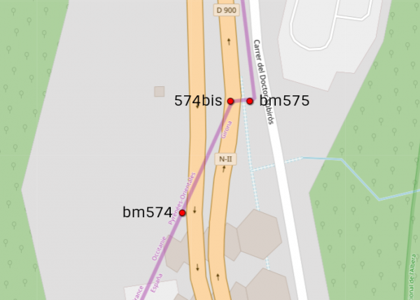
With the risen popularity of Le Perthus as a shopping paradise, the road was widened and bm574 was relocated about 50m to the SW. At its original spot, a metal plate (with ‘574’) was put at ground surface. We don’t know when that happened. This is a map of the scene:
The label 574bis is an invention of ours to distinguish both markers. The plate we are talking about is shown on this picture from 2008:

At the far end of the white line is bm574
But Carlos and Conchita Roca (website) couldn’t find it back in July 2019.

Picture of Carlos & Conchita Roca
Has it been stolen? Or damaged and removed? Or just being covered by a splash of tarmac for some unknown reason?