Category Archives: News 2020

Barry Arnold in the Pyrenees

Barry Arnold is one of those guys fascinated by borders: border-crossings in all kinds, border-phenomena, and in particular tripoints. His website (https://barrysborderpoints.com/) lists all his trips to various borders and tripoints.

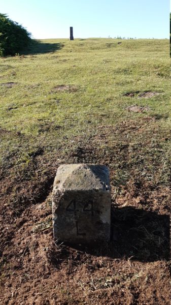
In August 2020 he traveled to the French-Spanish border in the eastern Pyrenees and documented thoroughly the ‘borderpoints’ he visited, including the two tripoints of Andorra. See this subpage of his website. Very interesting, very informative, very worth reading.

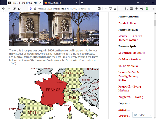
Noteworthy: he did the Llivia-circuit as well, covering all the Llivia-bordermarkers (soon to be added in his enclave-section). He is also one of the few among us who dared to climb the Pic de Medecourbe (western tripoint of Andorra). Also interesting: his account of the pene-enclave Os de Civis,  the only Spanish village that can be reached by car only by going through Andorra (link). He might consider – with his stamina – to do the Andorra-circuit.

Carlos & Conchita: halfway on their quest

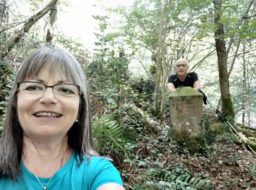
This cheerful couple from Barcelona started in 2016 with searching and photographing esfr-bordermarkers. This is their website.
First, they covered the eastern Pyrenees, east of Andorra. Then they made a crucial decision: let’s try to do all 602 esfr-bordermarkers. They worried a bit about their age (they look 55 but are actually a tiny bit older) and feared the long trips into the high mountains. But why not try? Jacques Koleck started when he was 71 and Michel Molia was 73 and they both completed the whole esfr-border.

Since yesterday you can follow their progress on this website-map:

The red markers are the ones still to be done, the green ones have been covered. You will also find yellow lines (bm’s done walking) and violet lines (done by car).

A few days ago, they reported me that they had found their 301st bordermarker implying they are halfway of the official 602 bordermarkers. 

Congratulations! You are going strong!

To be honest (and they know it): In fact there are more than 602 bordermarkers (double ones, extra ones, intermediate ones: see this page) but this one deserved to be celebrated.

Bordermarker-maintenance: someone has to do the job

On Tuesday 23-6-2020 I did two maintenance jobs near Col de Lizarrieta in the Basque country. I located the exact spot of a presumed lost borderplate and found it back. The second job was dragging the dislocated intermediate marker 44L back to its original spot and dig it in. Why? Because no one else does.

A bit of background: In 1988 twelve intermediate bordermarkers were placed near Col de Lizarrieta: 44A to 44L. On the broad and flat Col itself – between bm044 and bm044A – three plates were placed at ground level with an F and an E on it. Two of the plates still exist but the third one seemed to have disappeared or covered by tarmac.

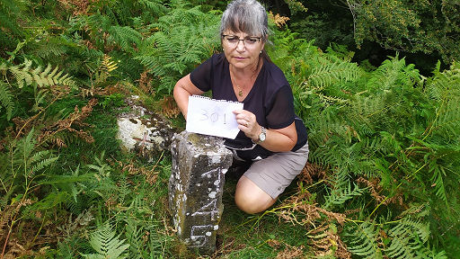
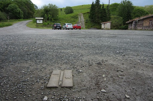
This is the second plate, the third plate should approximately have been placed underneath the red car.

Of the twelve intermediate markers, the 44L had rolled down the hill and was to be found for many years next to 44J. It seems no one cared…

Fortunately, the treaty of 1988 mentions the exact distances between the plates and the markers. See this page. So the exact locations of the third plate and 45L can be established quite simple with a landsurveyor’s measuring tape.

I arrived very early on the Col to avoid unwanted attention. My toolkit for today:

I started with measuring the exact spot of the third plate:
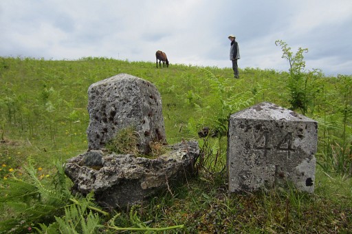
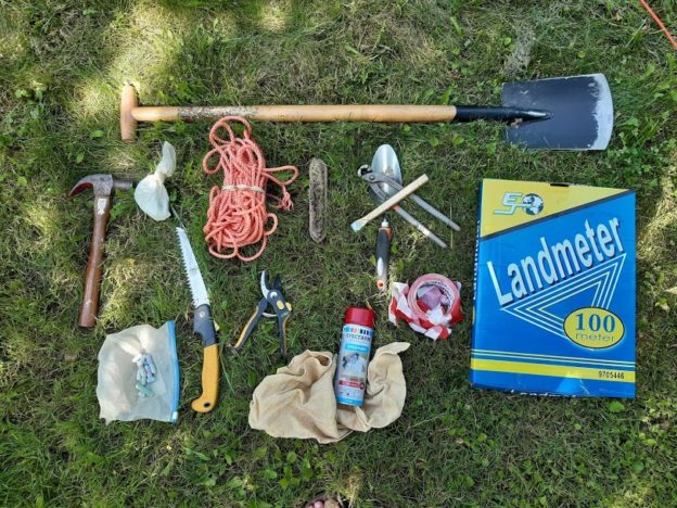
and start to dig and soon: Bingo!

Then uphill for the second job and measuring the distances from 44K and from 45 to establish the original location of 44L

Then digging a hole

and rolling the 44L uphill

And finally digging in 44L at his original spot.

Jobs finished in two hours, I’m very content. Someone has to do it.

Jean-Paul Laborie again on television

Jean-Paul Laborie is a commissioner of the Pyrenean border committee. As such, he is popular with the media and has appeared several times in newspapers-articles or on television.

His latest appearance on television was part of a news-broadcast (Le 13 heures du samedi 23 mai 2020) on the French TF1-channel. Not as an actual news-item but as a human interest subject on the bordermarkers of the Pyrenees. The video contains a lot of drone-made aerial footage, I like that.

Les-bornes-frontière-de-Napoléon – Le 13 heures du samedi 23 mai 2020_TF1 from Eef Berns on Vimeo.

The video has four parts:
– part 1: Jean-Paul visits Col du Portillon (bm366) and Col de Barèges (bm356 and 358) and gives some explanations

– part 2: a trip (without Jean-Paul) to the old mines of Bentaillou which are said to be close to bm420. In fact they are much closer to bm418/419 which is still a 2-hours walk from the mines. The guide points wrongly to a col (Portillon d’Albe) where there is no bordermarker and to a mountain top (Pic de Serre Haute) with a ‘borne’ visible. But that not a ‘borne frontière’ but a giant cairn.:

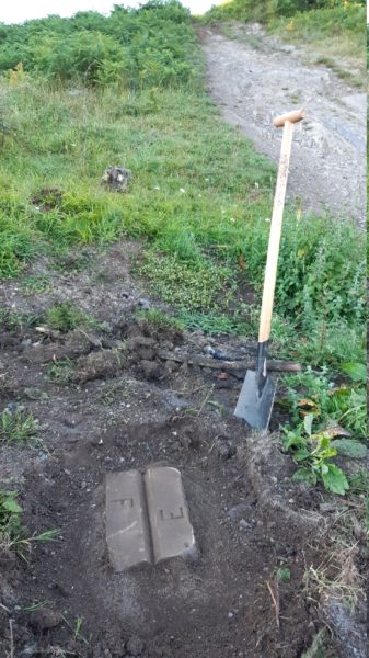
(Picture above borrowed from this webpage)

– part 3: two short visits to Llivia and Le Perthus

– part 4: Jean-Paul visits for the first time bm602 which is in a cave at the mediterranean coast. Bm602 is only accessible by boat or by swimming.

My video on the Bidaubus-conflict: how France is about to lose 8 hectares of its territory

I have published in the past several posts on the ‘Bidaubus-conflict’. The last one was http://blog.grpdesbf.nl/?p=710

It’s all about a border change on a hillside near Bagnères-de-Luchon, between the bordermarkers 407 and 409. France and Spain have agreed on a compromise in which France is about to lose 8 hectares of its territory. That is surprising because – in my opinion – the treaty is very clear about the right borderline. All the reasoning can be easily summarized in a 4-minutes video. It is in french to cross the language border. It might look a bit amateurish, but it explains well enough the inevitable logic of the treaty.