The evidence presented in the previous post has been confirmed by Charles Darrieu. He and his wife Josette tried in 2008 the first part of the shortcut, starting from Col d’Anaye. They didn’t have enough time to climb to the ridge but they found a cairn-waymarked trail uphill.
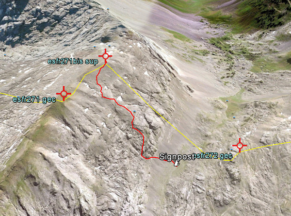
Moreover: Charles showed how on the Topopirineos-map (see next post) this trail is indicated. And moreover: on Google Earth we can even spot the beginning of it on Col d’Anaye.
I made a kml-file of this connection: esfr-bm271bis-272-connection-on-topopirineos.kml
Let’s show some pictures: first an overview of the connection on Google Earth.

And now a view towards Col d’Anaye , approximately on 3/4 of the route from uphill to the Col.

And this picture shows the very beginning, when started from Col d’Anaye. If fact it’s very simple: from the current wooden signpost at Col d’Anaye, climb straight N and soon you will pick up the trail (hito = cairn).

