

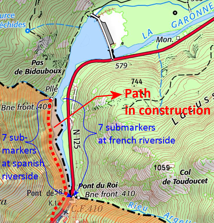
In the middle of the Pyrenees, we find the river Garonne, originating in Spain and passing into France at Pont du Roi. The borderline follows the thalweg (= the line of deepest points) of the river for ± 750m. marked by bm409 and 410 at the north and south side of that stretch.
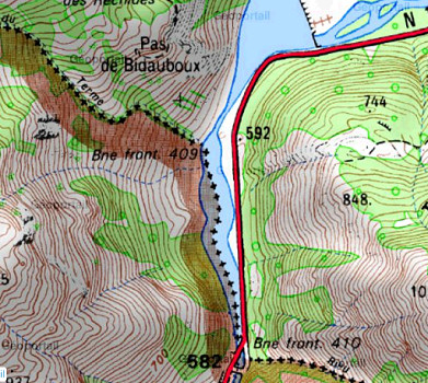
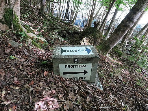
After the building of a barrage in France in the 1960-ies, the water level in the riverbed increased and its width got enlarged. To mark the borderline (thalweg) in the river 14 submarkers were placed along the elevated riversides. Seven on the Spanish riverside and seven on the French side, each showing the distance to the thalweg. They all look like this one:
Carlos and Conchita Roca (of this website) discovered last week that at the Spanish side, a concrete path is in construction, connecting the Spanish road south to bm409.
Let’s show some of Carlos & Conchita’s pictures:
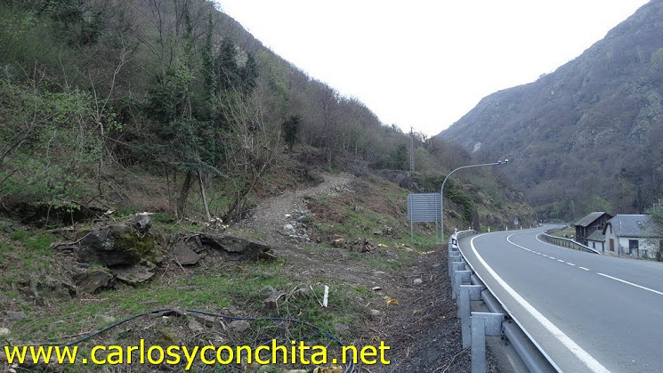
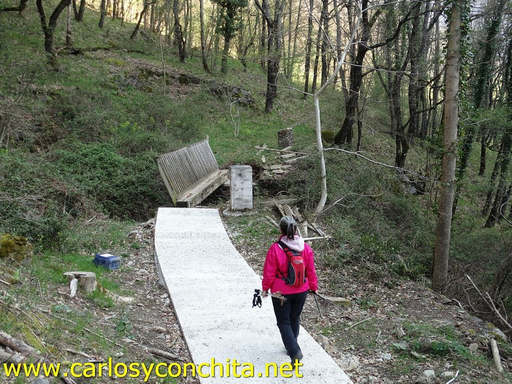
This picture shows the connection to be made with the Spanish road.
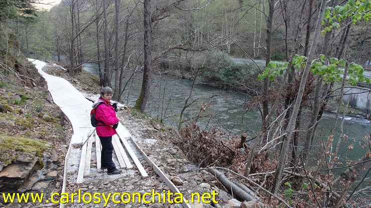 Further on we see how the concrete path-in-construction looks like.
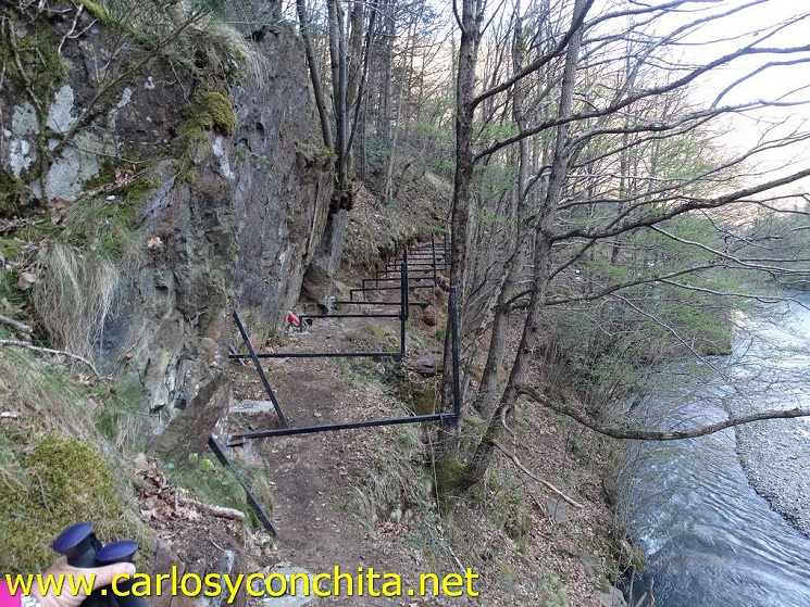 At the narrow parts, they are working at these kinds of constructions.
 The concrete path is ending at bm409, with no sign of an extension north on French territory.
One wonders why such an effort is made: there was already a decent and scenic track along the river. A bit of improvement, safety cables at a few vertiginous spots, and a clear connection to the road south would have done the job. Never mind, I have another goal to check out in the summer when we can travel again (hopefully).
Interesting! It does seem a lot of work to go to, somewhere fairly remote.
I notice that Google Maps calls it the Pont de Rei .. might be Catalan? Just up the road is the “Casino de Pònt deth Rei”
Yes, Jerry, ‘Pont de Rei’ is the Catalan name for Pont du Roi. About the casino: once – fifty years ago – there was another one, close to bm409 but still on Spanish soil and easily accessible for gamblers from France. Its premises are now under water level since the building of the barrage.
Interesting, as always… Sometimes the most educational aspects for the reader are not what the writer intended but the tangents that an easily distractable reader (like myself) goes off on… Here, I am referring to the semantics of the term “Thalweg”–you tell us (parenthetically) the sense you are using, i.e., the line of the deepest water, the lowest points of the watercourse–you are using it in the proper technical sense that a geologist or hydrologist would, and as the sense of the term in German suggests. .. However, there are two other senses of the term that can sometimes lead to confusion. The second meaning one sometimes sees is the line of the fastest water flow. In a straight river, that will usually be the same “Thalweg”as the first sense, but not necessarily; in a stream that meanders over relatively flat land, centrifugal force will sometimes make the outside of a bend the point of fastest flow, which is not necessarily the deepest part… The third sense of “Thalweg” –and one commonly used in international law relating to the placement of a political boundary– is the middle of the main channel used for navigation– which (again) might or might not be the same line as defined in the first or second senses… Thanks!
Thank you David, an illuminating petit discourse on the various meanings of ‘Thalweg’. Cordially, Eef