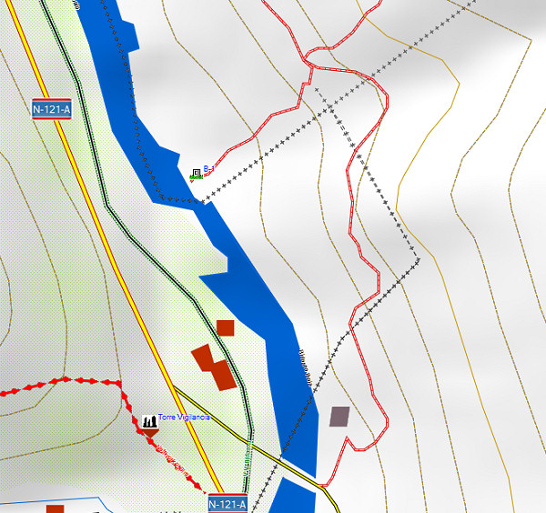
I was surprised to learn from Charles Darrieu that there is an extensive and free hikingmap of the Pyrenees. It’s built to be used it in Garmin-software (Mapsource / Campbase) and on Garmin-gps-devices. You can download it from http://topopirineos.blogspot.fr/
Installing this map-software wasn’t that straightforward (at my computer): in the download-process the two files were renamed and that prevented a proper ‘unzipping’. So: when you have downloaded both files, check of they have the following names: ‘TOPO PIRINEOS 6.1.part1.rar’ and ‘TOPO PIRINEOS 6.1.part2.rar’ (of course without the ‘). If not, rename them. Finally you can ‘unzip’ them with software like Winrar of 7-zip. The unzipping gives a giant .exe-file which does the final installment. In Mapsource or Campbase you can chose this map as map-layer.
And what does this map offer? Well, every bordermarker is indicated (pillar or cross) but most of all we see many, many trails which we don’t see on the official IGN-maps. You can distinguish between official waymarked trails (and see their names) and other trails. It’s a treasury! An example: the access-routes to bm001:

