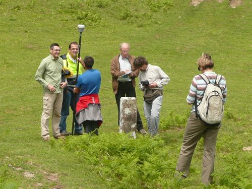
I came across two Spanish newspaper-articles (this one and this one) on a project in mid 2013 to establish with a gps the exact coordinates of the bordermarkers 1-272 and the borderline in between them. The same project should already have been undertaken at the Catalonian border with France (bm333-602).
As we know, the position of the borderline and bordermarkers and their representation on maps is not always clear and unambiguous. I have made my own list of Cartographic errors & omissions on this page.

On this picture we can see how the measurement is undertaken with professional = highly accurate gps-devices. Ordinary gps-devices (like the one I use) loose their accurateness significantly in wooded and tilted places. That makes one possessive: where can I get these super-precise GPS-data? And very important: what did they do with the bordermarkers which have disappeared: bm236, 255 and 271bis?
By the way: my own coordinates of all bordermarkers are downloadable on this page.
