I have discussed in previous posts the borderline between bm407 and 409 several times and was critical of the new borderline of the CMA 2015. In my opinion, the French delegation had the best cards in every respect but gave in to the Spanish far too easy. Who would care, they might have thought. Well, I do!
The head of CNIG-department, charged with the digitalization of the French border – Pierre Vergez – is a strong defender of this compromise. He asked for a ‘right of reply’ in the way of a Gif-animation. Here it comes:
My comments:
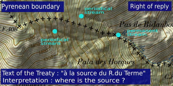
1. the treaty is not speaking of a source but of the “origine du ruisseau du Terme” and “la naissance du ruisseau du Terme”. That does make a difference: every stream has a beginning, it can be a well-defined source (water bubbling from the ground) or a ravine where somewhere the rainfall or melting snow merges enough to form a stream. If that is a permanent or periodical beginning or stream is not relevant in this context, the treaty doesn’t make such a difference. Sources and origins of streams on upper hill slopes tend to be periodical, subject to season and rainfall/snowfall.
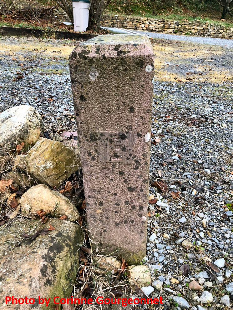
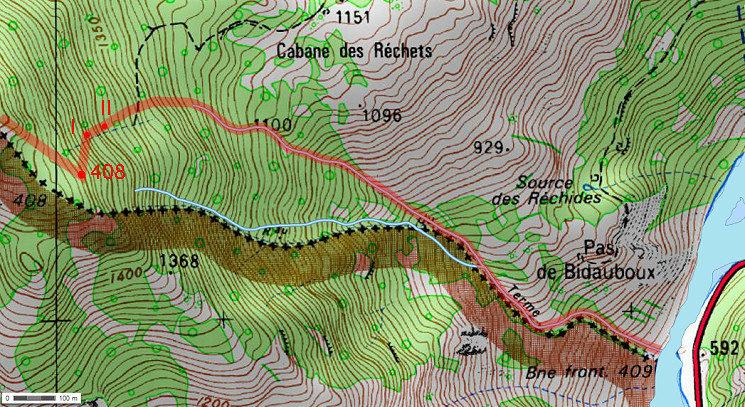
2. the bordermarker B.F. 408 is shown at a wrong place.
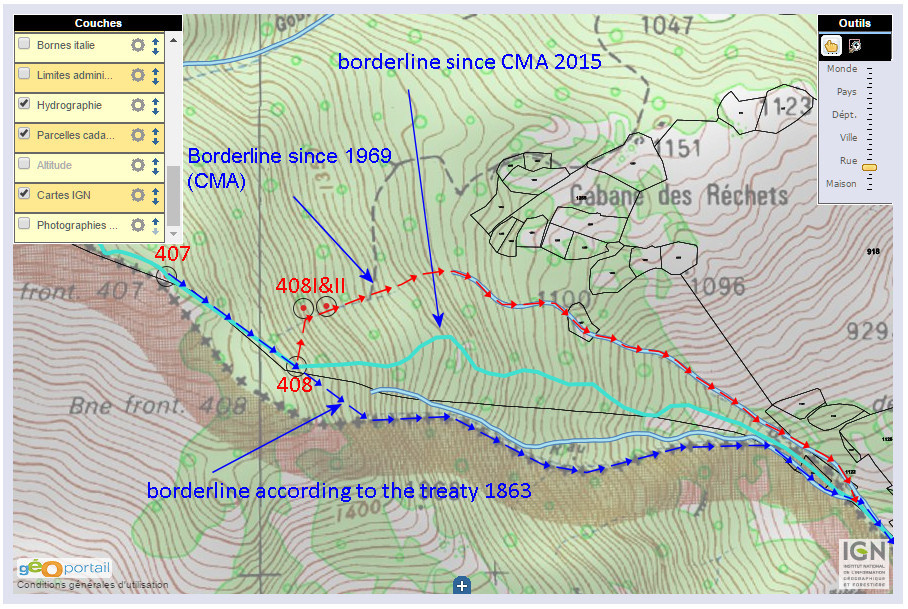
3. the new borderline (CMA 2015) was a compromise: they cut the disputed terrain in half. From bm408 it follows a ridge between the two streams of the two ‘interpretations’ downhill to a point where the two streams merge. It no longer bears relevance to the Treaty-text: a direct line from bm407 to a stream with bm408 above its beginning.
4. Pierre Vergez has made his own calculation and brought down the loss of French territory back from 8 hectares to 5 hectares.
5. ‘Scientific proof’? What would that mean? Close reading of the treaty text and plain thinking will do the job.
Do I have a tunnel-vision?
Mr Vergez accused me of a tunnel-vision on the interpretation of the Treaty. I should consider other interpretations and ask myself how the origin of the Ruisseau du Terme could be perceived from another point of view. However, he didn’t tell which interpretation of the Spanish delegation was so convincing that they had no choice than to seek a compromise.
And a tunnel-view? Well, he underestimates me. Of course, I did this mental exercise before. The border-conflict around 1960 (see this webpage) was centered around the same question. Let’s show which other interpretations are possible and discuss them.
The facts to start with
1. The treaty-text (in English)
“From bm407 the borderline leaves the ridge and heads directly on the northern slope to the origin of a stream, the “Ruisseau du Terme”. Bm408 is placed 312m from bm407, on a rock above this beginning of the stream. Then the border follows the course of the stream until its confluence with the Garonne where bm409 is placed.”
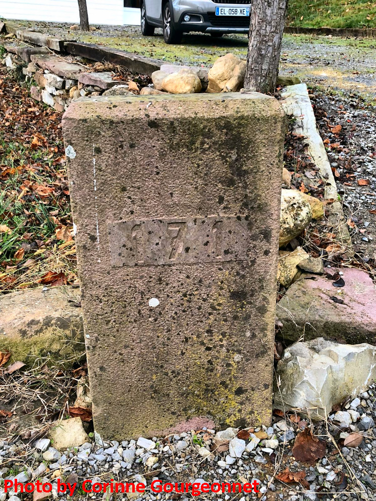
2. The historical locations of bm407 and 408, disputed by no one. Though rebuilt in the 1950-ies, their ruined predecessors were still present. That’s how the treaty was implemented in the 19th century and only challenged around 1960. Don’t forget that the rebuilding of the bordermarkers in the 1950-ies was a bilateral project and finished with a mutual declaration of agreement on their locations. In the 1960-conflict, the position of bm408 was nu subject of discussion.
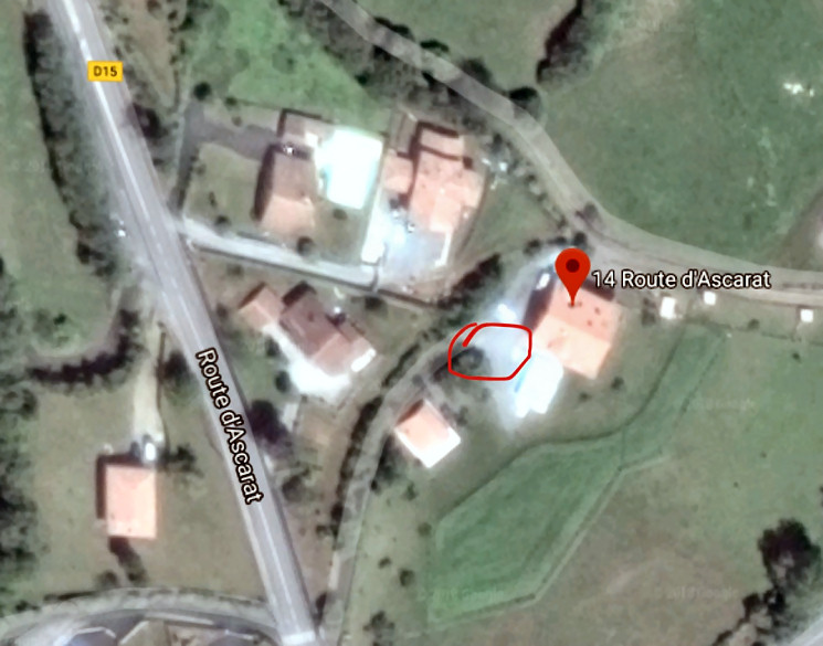
A better map of the situation
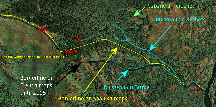
We can see on a Google Earth-background the two borderlines on the French and Spanish maps (before 2015) and the various streams which finally come together and merge with the Garonne. We can identify three beginnings or origins or sources of streams. Thus there are three candidates for the origin of the Ruisseau de Terme. Let’s start with spelling the treaty-text and see which candidate fits best.
“(From bm407) the borderline leaves the ridge and heads directly on the northern slope to the origin of a stream, the “Ruisseau du Terme” -> there are three options available
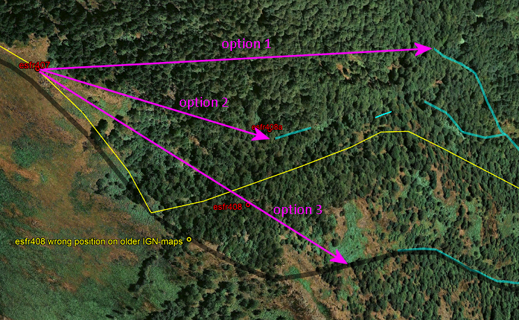
Option 1 can be eliminated easily: the distance is too far (± 675m), there’s no rock nearby for bm408 to stand on and this cannot be fitted in the description of a borderline leaving the ridge and continuing on the northern slope of it.
Option 2: this is where in the 1960-ies bm408-I was placed at the top of a small cascade-like stream. However, it is not a continuous stream downhill, not even with a continuous streambed and one could ask if they are not separate streams. But never mind, we keep this option in competition.
Option 3: no comment, qualifies straight away for round 2
Round 2: two options left
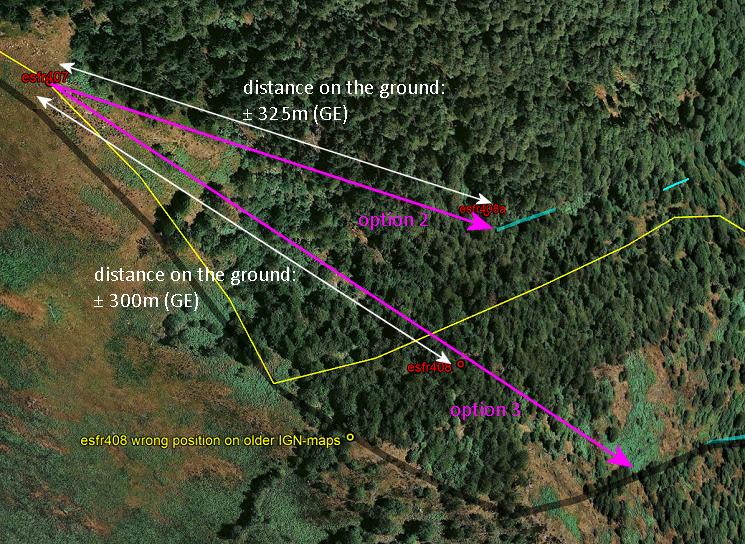
We have two options left which both match with
– a direct line to the origin of a stream
– with a minimal distance (on the ground, measured in Google Earth) of ± 300m because bm408 has to be placed at 312m distance on a rock above it’s beginning.
Final choice
Without the actual and historical location of bm408, both options would make sense. But given the position of bm408, there is only one option reasonable: the direct line heads via bm408 to the origin of the Ruisseau du Terme. Otherwise, the direct line would have been a bent line: from bm407 directly to bm408, bending sharp north to option 2, let’s show that:
And that’s a silly thing to think. It was already in the 1960-conflict a peculiar thought, incompatible with common sense. Plain thinking involves: a direct line is a straight line and bordermarkers are placed on the borderline unless stated otherwise.
But our discussion not yet finished: 2 counter-arguments to deal with
1. could bm408 have been placed outside the borderline but still “on a rock above the beginning of the stream”? In that case, the direct line goes from bm407 straight to option 2 and that would make option 2 the “Ruisseau du Terme” of the Treaty. Does that make sense? Answer: no. Why would they have put bm408 at a distance of 100m south when a suitable position was available at the current position of bm408-I? And why not mention it in the Treaty?
Moreover: the ‘rock’ of bm408 is steep above the hillside SW (towards the Ruisseau du Terme) and S of it but provides a more gentle descent towards the cascade-like stream. Thus, the description of “a rock above” wouldn’t suit if the cascade-like stream was meant to be the origin of the Ruisseau du Terme.
2. could bm408 have been placed (or rebuilt) at a wrong place? Though Jean Sermet tells us that there was a ruined predecessor present at the spot in the 1950-ies, there are nowadays no remains visible. But as said: the project of rebuilding the bordermarkers in the 1950-ies was a bilateral project completed with a mutual declaration of agreement. So both parties complied with the rebullding on this spot. So: is this presumption plausible? Answer: no.
Conclusion
After examining several options, there can be no reasonable doubt about what is meant in the Treaty. Other options simply do not fit in the treaty-text and the given locations of bm407 and 408. The borderline from bm407 onwards goes in a straight line via bm408 to the ravine where the Ruisseau du Terme has its beginning. On a map:
And I have to repeat my verdict: the French delegation in the CMA 2015 didn’t do their job well. They gave away 5 hectares of French territory in an easy compromise.
Erase my name
Pierre Vergez asked if his name could be erased from my previous posts. I thought about that, my remarks on his role, reasoning and attitude were not too flattering and this is not a personal vendetta. On the other hand: we are talking about public matters – the integrity of the French territory – and he has responded not as a private person on personal matters but as a civil servant to the public. Then you should take responsibility for what you write. He was not pleased: “I am embarrassed that my name is mingled with the empty rhetoric of the internet. Thank you for removing it from your fantasies.” and “I m chocked to see such fake News on internet. I was patient enough to reply to you, but by évidence you aren’t able to be honest enough to write my point of view. I think the best way is to show around your name and internet site as liers.”
Well, so be it.


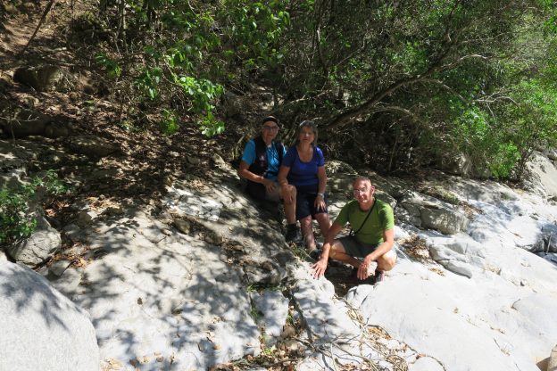
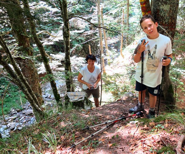
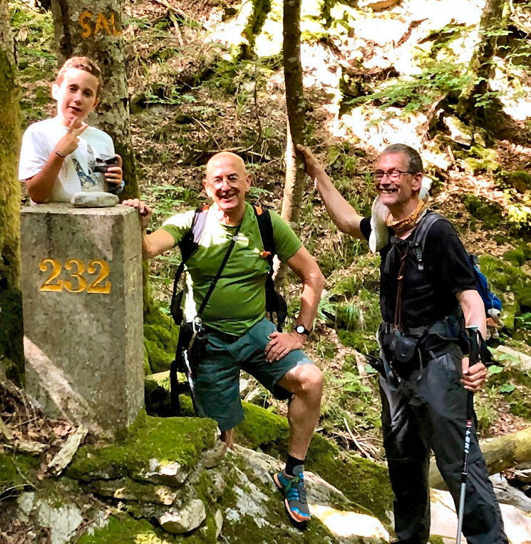
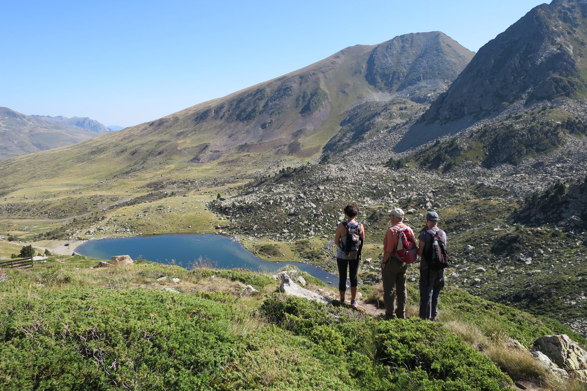
 All went well and my ‘clients’ were delighted to have covered this gap in their collection from Andorra to the Mediterranean. And I was content with their cheerful company and their perseverance. At the foot of bm542 a portrait of us three.
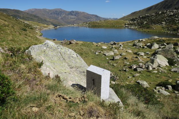
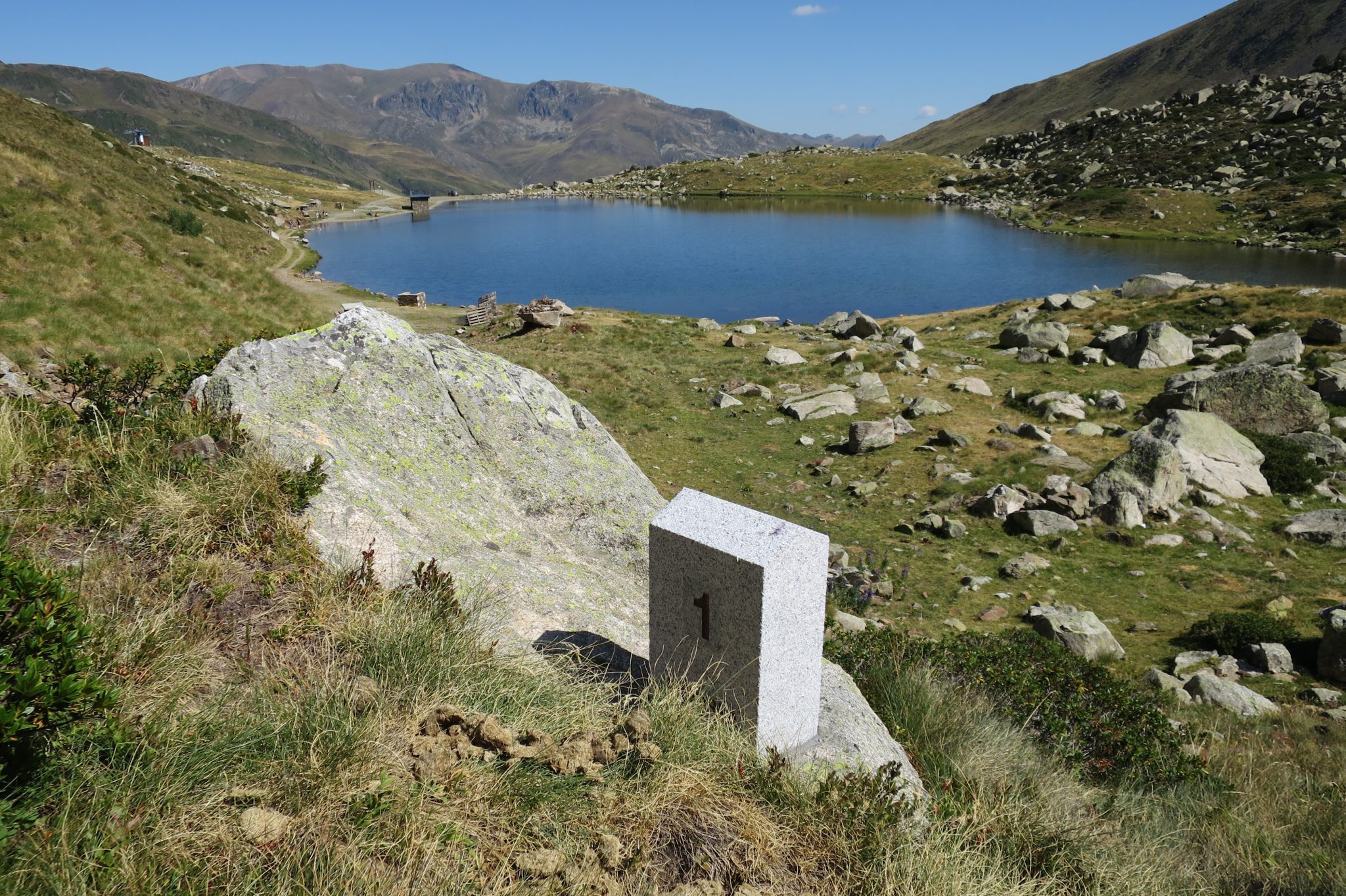

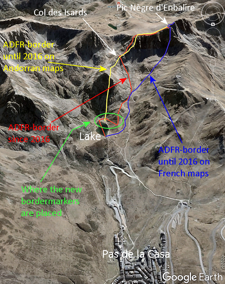
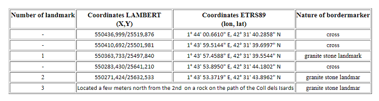
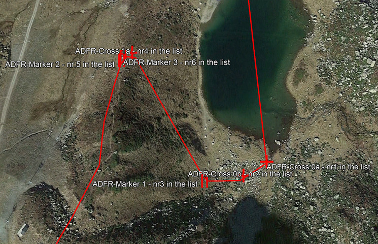
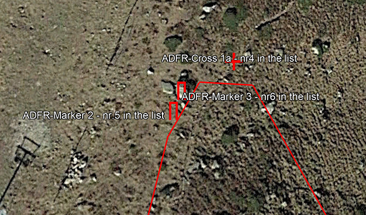
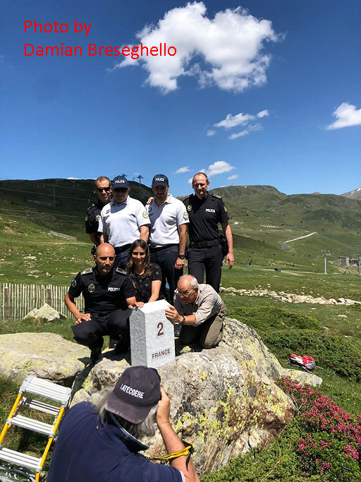
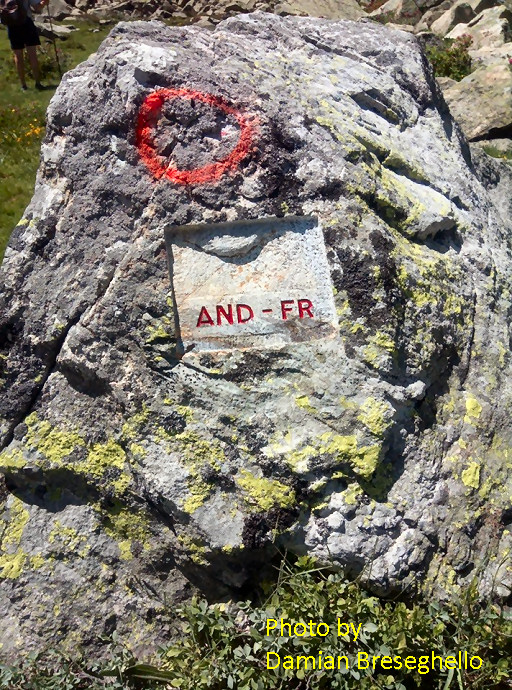
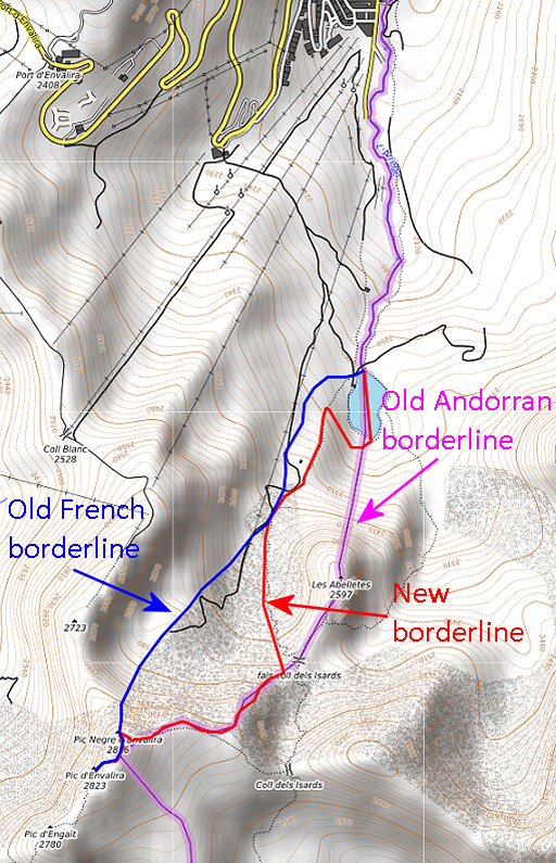
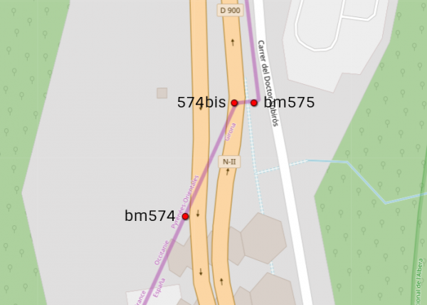
 The negotiations resulted in a new borderline between Col de Isards and the northern point of the lake which has been materialized in recent months by six bordermarkers: three markers and three crosses. Three questions remain to be answered: where are these new markers and crosses placed, how do they look and what is the logic of the new borderline. Let’s try to answer them. But first another map showing the old and new borderlines and the location of the new bordermarkers.