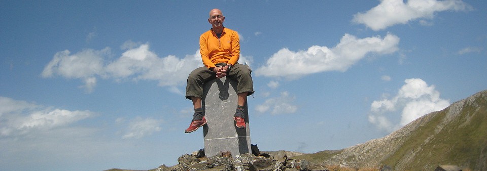
Well, it’s a nightmare for Jesús Murueta. He has ‘done’ the esfr-bordermarkers 1-272 in the years 2000-2003, finding all these bordermarkers or getting an old picture of the few markers which are are lost. See this post for his story and to download his extensive account.
There’s one exception: bm271bis. It was a bordercross on the isolated and rough ridge of Añelarra near Pic d’Anie. It has long been reported (on the French topographic maps) as being destroyed and no one in the last decennia has found any trace of it and we have NO old pictures. This keeps haunting Jesus Murueta: a picture would fulfill his bordermarker-quest. Who can help him?
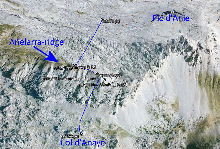
But there’s an important question: what was in fact the location of bm271bis? The esfr-border follows in this part of the karst-plateau a a zigzag-line with a straight part on the Añelarra-ridge for a few hundred meters.Let’s show it on this Google-Earth map:
The Añelarra-ridge has two summits. Bm271 is at the western summit and nowadays we find a geodesic marker of Navarra, close to it (with D.F.N. on it = Diputación Foral de Navarra). That makes sense. The second summit is at ± 240m to the east and could make a logical location for bm271bis. Here we find today an iron plaque with the contour of Navarra and a large cairn.
But the topographical and historical evidence is different! The original treaty says that bm271bis is 360 meters from bm271 on the same ridge. But we have to acknowledge that the distances between the previous bordermarkers 262-271 – as mentioned in the treaty – are often unreliable.
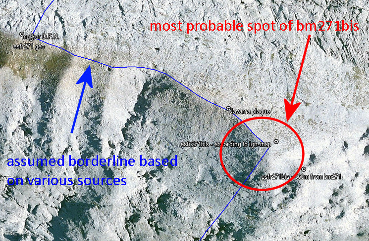
The location of bm271bis on the IGN-maps is ± 310m from bm271 when following the ridge. And that position makes more sense. The ridge descends and bends slowly in the direction of Pic d’Anie. It’s a logical/natural place for the borderline to bend southwards and descend towards Col d’Anaye. Let’s zoom in:
I have to return and do a new search, now focussed on the lower half of the red circle. The upper half and center of the circle, I searched thoroughly on this trip.


