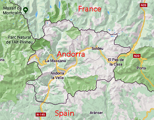
I was very surprised by this very interesting article which tells us that in spring 2018 bordermarkers will be placed between Andorra and France. And that means the first bordermarkers ever between both countries. Their border was never officially delimitated.
On my own webpage on the tripoints of Andorra you can read: “The Andorran constitution (1993) states that the borderline is the ‘traditional one’. However, in two areas Andorra and France/Spain came to a delimitation act. The first is about the border of the Andorran parish of St. Julia de Loria with Spain (1856). The second (2000) delimited the border near the French village of Porta.“. That last one was in order to build a tunnel.
In 2012 an agreement was signed for the delimitation of the whole Franco-Andoran border, the borderline was digitally measured and now the installment of the bordermarkers is scheduled for spring 2018. You can imagine that I’m very curious about: how many, which numbering, which places, their shape. It will involve new bordertrips and I can’t wait.
The article contains links to a few audio-recordings. One of them is an interview with the well-known Jean-Paul Laborie, member of the commission d’abornement franco-andorane. A previous article tells more about the conflict on the control of the water supply from the sources of the river Ariège.


Well EEF, we are all waiting for your first pics from this new demarcation….! :-))
De nouvelles recherches en perspective cet été ? Merci