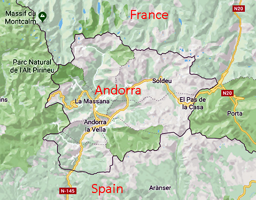
In the Pyrenees, close to Bagnères-de-Luchon at the Bidaubus-hillside, France has lost 8 hectares for no reason. In a way, it is kept secret, decided upon in closed meetings with no publicity or justification. Can it be reversed?
The Bayonne Treaties 1856-1868
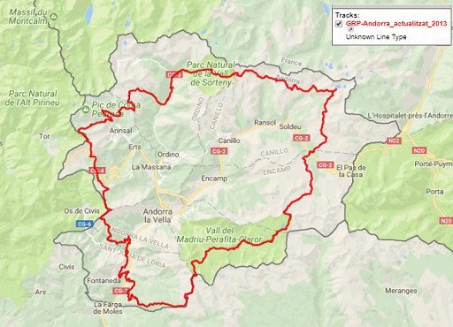
France has a vast length of borders with its neighboring countries. In the south, it’s the borderline in the Pyrenees with Spain and Andorra and that’s the one I’m very familiar with. Once – in terms of binational agreements – it was a vague line but since the 19th century, a very well described borderline complemented by more than 700 bordermarkers. The so-called Bayonne treaties between France and Spain were a result of decennia of investigation, negotiation and tough fieldwork.
Digital measurement of the border
The digital age offers new possibilities to delimitate the border more precisely. That’s where the European INSPIRE-project stepped in from 2007 onwards. The borderline and bordermarkers between France and Spain are precisely measured with gps-devices and the results discussed in the binational committee of the Commission Mixte d’Abornement (CMA). However, in this case (CMA-meeting 2015) its proceedings are not public and we have no idea which arguments were exchanged in case of disagreement. But we can watch the results of the fieldwork and the level of CMA-agreement on this webpage with a nice explanation on this webpage.
The CMA and its important meeting in 2015
The CMA is a binational committee with a long history, discussing and deciding on border-matters and bordermarker-issues on the French-Spanish borderline. There are 4 Spanish members and 3 French members. Its agreements can involve changes of the borderline, apparently without a final binational treaty needed to implement the change.
In 2015 the results of the INSPIRE-fieldwork was discussed in Toulouse and the digitally established borderline was approved. As said, you can check that on the map on this webpage: if the borderline is blue, it is approved. Are there any disagreements? Well, they only mention a since long disagreement at the far western side of the Pyrenees concerning the river Bidassoa.
Still, there are at least two cases in which the borderline was changed, one of them is the border on the Bidaubus hillside. Unfortunately, the proceedings of this meeting being not public (though the proceedings of 2014 and 2012 are available on this page), one wants to know the reasoning.
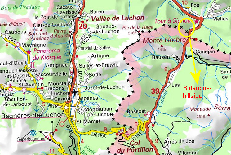
The Bidaubus hillside
The Bidaubus-hillside is near Bagnères-de-Luchon and SW above the peaceful village of Fos. That’s where the borderline leaves the mountain-ridge and descends to the Garonne. The treaty of 1863 is very explicit about the borderline leaving the ridge from bm407 and going in a straight line via bm408 to the origin of the stream (Ruisseau du Terme) which descends as the borderline to the Garonne. The text itself tells us:
407. Borne au cap de Touète
En ce point, la ligne internationale abandonne la crête et descend par le versant septentrional pour aller directement à l’origine du ruisseau du Terme, appelée aussi Riou-Poudét.
408. Borne sur un rocher, au–dessus de la naissance du ruisseau du Terme, à 312 mètres de la précédente.
La frontière descend par le cours de ce ruisseau jusqu’à son embouchure dans la Garonne.
409. Borne à cette embouchure, sur la rive droite du ruisseau et à la rive gauche de la Garonne.
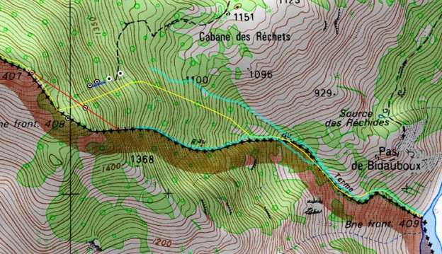
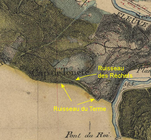
In my own words: from bm407 the borderline leaves the ridge and heads directly on the northern slope to the origin of a stream, the “Ruisseau du Terme”. Bm408 is placed (NB: thus in between, inevitably on that direct line) 312m from bm407, on a rock above this beginning of the stream. Then the border follows the course of the stream until its confluence with the Garonne where bm409 is placed. On a map:
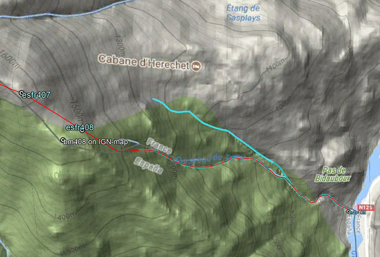 NB: note the northern stream, important in the Bidaubus-conflict in the 1960-ies. It is called the Ruisseau des Réchets. The Spanish argued in the 1960-ies that this stream – as a prolongation of a tiny stream cq cascade NEE of bm408 – should be considered as the Ruisseau du Terme from the Treaty. That is silly because -in that case – the border-commissioners of 1863 would have placed bm408 at another spot.
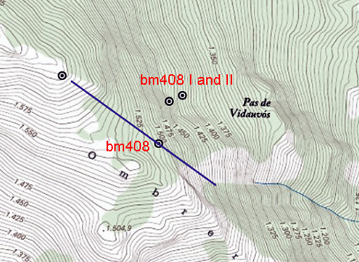
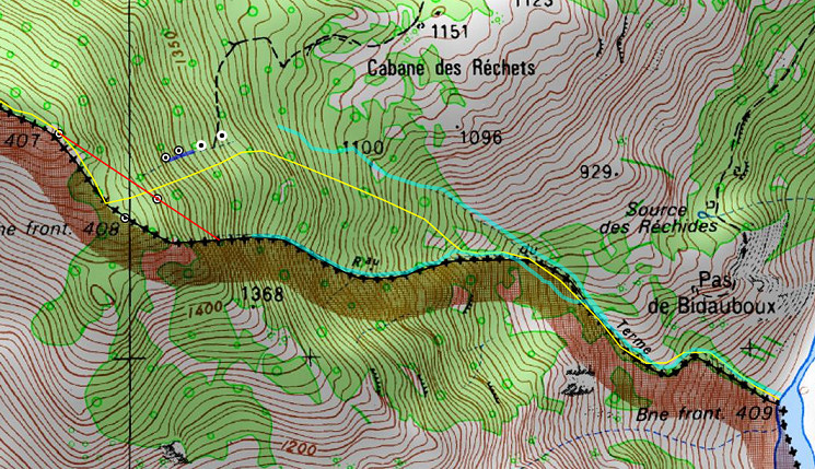
The original locations of bm407 and 408 (which were rebuilt in the 1950-ies) are indisputable because the foundations of the original markers were still there in the 1950-ies. Henceforth the borderline as meant and implemented by the 1863-treaty leaves 0% doubt, it can not be interpreted differently. Let’s show it how that upper part looks on the Catalonian ICC-map with its very precise elevation-representation:
And look at this historical map (l’État-Major, somewhere between 1820 and 1866, probably drawn before the Treaty of 1863) which shows that in the 19th century the Ruisseau du Terme was considered as THE borderline (and not the Ruisseau des Réchets)
The Bidaubus conflict 1959-1969
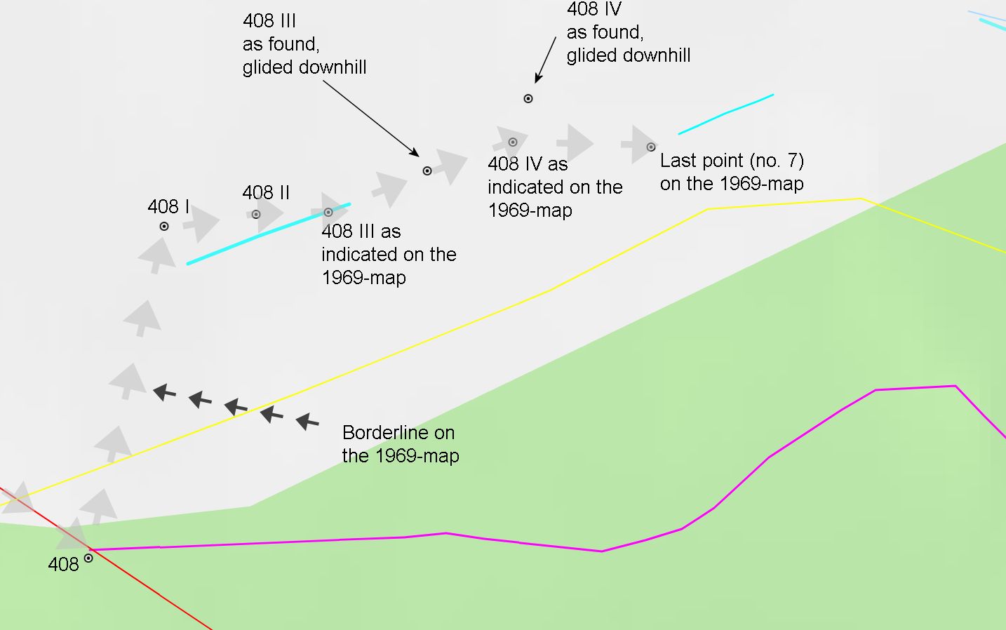
A Spanish forestry company trespassed the borderline in 1959 and that led to a chain of events. The French border commissioner Sermet and his Spanish colleague Alija agreed to change the borderline as a sort of diplomatic solution and the CMA complied. The borderline between bm408 and 409 shifted to the North, ceding terrain to Spain. Four submarkers (408 I-IV) were placed in 1969 to delimitate the new borderline but only nr. I and II are still in situ and III & IV were unfindable (until spring 2018). A cadastral map with the new markers was drawn in 1969 but seemed to be lost. And thus it was not known how the new borderline was envisioned and subsequently how much terrain was ceded to Spain.
The French IGN-maps didn’t change at all and the Spanish map was already wrong before 1969 and remained the same. Not that anyone cared, the locals of Fos kept on using the terrain as ever and nowadays they are ignorant of whatever border change, submarkers or conflict.
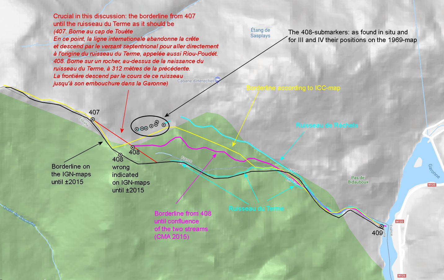
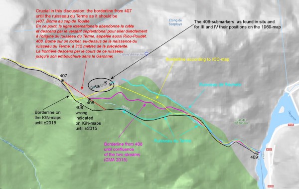
 The above map shows the different borderlines on various maps. Bm408 is wrongly indicated on this French IGN-map. Bm408 is located (and has always been) at the red line. Legend:
Black = borderline on the French IGN-map, since long
Yellow = borderline on the Spanish ICC-map, since long
Red = the borderline from bm407 via bm408 to the beginning of the Ruisseau du Terme, according to the Treaty of 1863
Light-blue streams: their courses derived from the very detailed Spanish ICC-map and the google-terrain map.
May 2018: submarkers bm408 III and IV found back
Michel Molia managed to recover the map of 1969 from a Spanish archive and the markers III and IV were discovered on 31 may 2018. See that page for more details. They were roughly placed in the same line as 408 I-II but had slid away and were half buried. The following map shows it all.

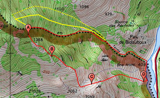
What does this mean? It made it finally clear how the new borderline was finally meant to be in 1969, ceding about 16 hectares to Spain as shows the next map:
 The red line is the new borderline of 1969 according to the cadastral map combined with information by Jean Sermet. As said, it was approved by the CMA of 1970 in Madrid.
CMA 2015: a peculiar compromise
Back to 2015. The INSPIRE-project to delimitate the border precisely prompted the CMA of 2015 to decide what to do with the borderline between 407 and 409. As said: the Treaty is – in my opinion – unassailable about its right course but how to deal with the dubious new borderline established in the 1960-ies? And – besides – what was its exact course without knowing the position of the lost markers 408 III and IV? I guess they assumed the new borderline to be as in the above map.
One thing is sure: the French delegation had the best cards with the explicit Treaty-text, the undisputed locations of bm407 and 408 and the evidence of the État-Major-map. They had thus THE chance to restore the border to its original and rightful course. But they agreed to the most simple solution, cutting the disputed terrain in half. Still a loss of ± 8 hectares of French territory compared to the pre-1969 situation. The next map summarizes all my data and reasoning. The purple line is the borderline from 2015 onwards. From bm408 it follows a minor ridge between the two streams until their confluence on the lower part of the hillside.
 The purple line is however incompatible with the Treaty-text and ignoring the historical evidence of the bordermarker-locations of bm407 & 408 and the borderline on the l’État-Major map of the 19th century.
The role of the CNIG in the CMA-decision
Pierre Vergez is a high-rank civil servant of the CNIG and in charge of the project to digitally establish the French borders with its neighbors. He was so kind to answer in 2018 on several occasions to Michel Molia and me on this subject, however surprisingly unkind by his militant and derogatory – my appreciation – way of answering. Perhaps he was annoyed by ‘amateurs’ like us, putting in doubt the decision of the CMA of 2015 which he labeled as an “intelligent” diplomatic masterpiece about some “useless square meters”.
He mentions opposing views of the Spanish delegation they had to deal with but what is there to oppose when the odds are completely at your hand? Or was he embarrassed by our documented knowledge concerning the 1863-treaty and the Bidaubus-conflict. While all this knowledge is abundantly available on the internet and assembled and discussed on our websites. I don’t think he did his homework well, neither did the French CMA-members.
What stroke me most: in so strongly defending the CMA-decision, he acted as if he was the chairman of the CMA while not even being a member. At his best, he should have been an impartial consultant to the CMA. But I guess that it was he himself who came up with the “intelligent” idea of following the ridge between the two streams. A convenient technocratic solution fitting a technocratic civil servant from far-away Paris but – as said before – incompatible with the borderline that the authoritative Treaty-text of 1863 prescribes and the historical evidence. I can imagine how the Spanish eagerly complied with this compromise.
But despite my personal irritation, probably reciprocal, we shouldn’t blame him. The French members of the CMA are responsible for agreeing with this compromise and in my opinion, they didn’t perform their job well.
Consequences for the undivided common ground of Bidaubus
There is a large terrain of common ground south of the Ruisseau du Terme, common for the communities of Fos (French) and Bausen (Spain). See this page for more details. If the northern stream of the Ruisseau des Réchets is upgraded to a presumed borderline, considering it as the Ruisseau du Terme meant in the 1863-treaty, the common terrain is inevitably expanded to the North. Let’s show it on a map.
That would imply expansion to the Ruisseau des Réchets (yellow dotted line).
In any case expanded to the new borderline (yellow line) between the two streams. What does that mean in a practical sense? For example, hunters from Bausen will have the full right to enlarge their scope to the North. Same story for collecting mushrooms or cutting wood.
Conclusion
France is about to lose 8 hectares of its territory for no reason, in fact it has already. Is it too late? I don’t know how omnipotent the CMA is in its decisions or in what way local authorities and communities can initiate a reconsideration of this decision.
And who cares? Well, I do! Never thought that I – as a Dutchman – would end up as a defender of French territory….


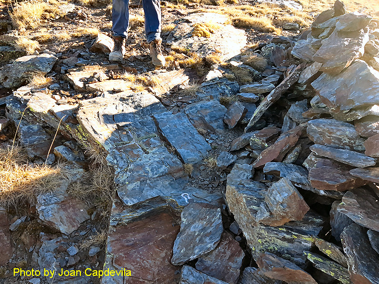
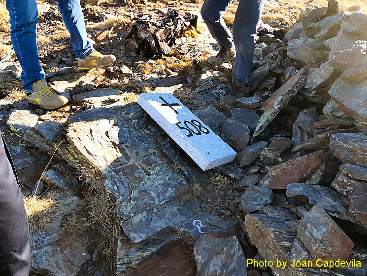
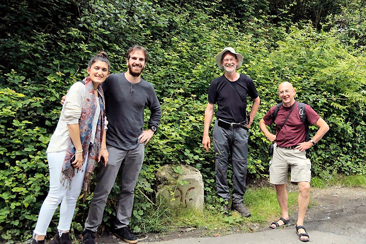
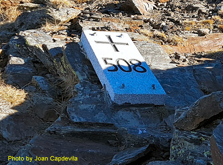 One can argue if it would have been more elegant to place the granite plate just besides it, so as not to cover the original engraved cross. But I herald the efforts of the cross-border commission to maintain and restore the bordermarkers which are lost or damaged. And this restoration gives a good reason to return to this fabulous border-ridge for my own pictures.