Author Archives: Eef Berns

About Eef Berns

Since 2000 I'm on a quest for the bordermarkers in the Pyrenees. My project is to find & photograph & document them all. And to connect them with a long-distance trail: the Grande Randonnée Pyrénéenne des Bornes Frontières About me: I was born in 1957, work as a psychiatrice nurse and live in Eindhoven in the Netherlands..

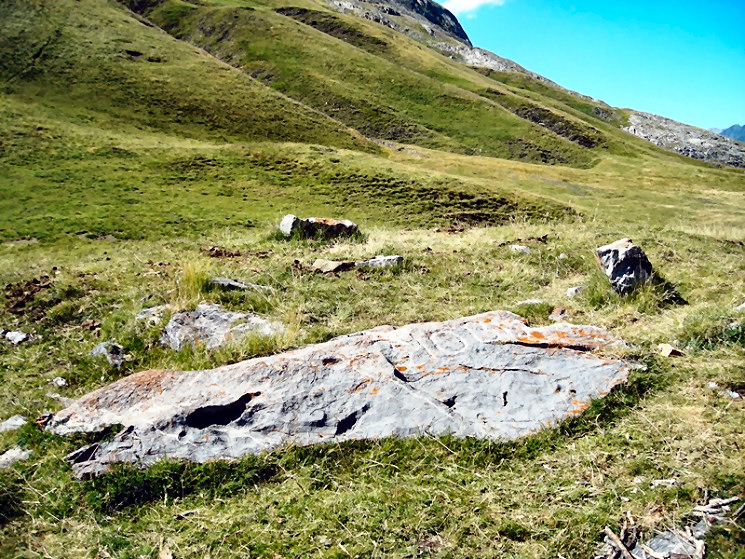
Another cross found near bm002

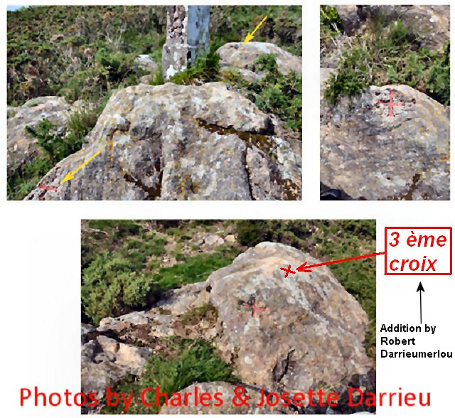
We know that there are several crosses engraved close to bm002 and bm007. See this webpage on my website. They are older than the current bordermarkers and marked the border when there were not yet numbered markers. Close to bm002 there are two crosses engraved in the rocks but Robert Darrieumerlou recently found a third one on the rock 2 meters behind bm002.

He shows that third one on my compilation of the pictures of the Darrieu’s. But you can see this third cross far better on his own picture on this webpage. It seems so visible that one wonders how other searchers could miss it (but I didn’t find any of them).
And Robert found another unnumbered cross, between bm001 and 002 and the altitude of 245 meters: see this page

Another proof of bm310bis

We only recently know that there is a bordercross 310bis although it wasn’t mentioned in the original “Traité” (=delimitation-treaty). See this previous post.
We don’t know when of why it was engraved. But it exists.

And this picture is another proof. Robert Darrieumerlou (thank you, Robert) found this picture on this website.

The Basques love their bordermarkers

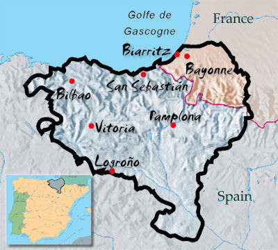
More and more I encounter names of Basques, keen on finding and photographing their share of the bordermarkers of the Pyrenees. And that’s the range from bm001 to bm272 and that amounts to 40% of all esfr-bordermarkers!
Carlos Sanz and Iñaki Vigor have even described a 206km-trail along those range in their “Travesía de los Mugarris”. And Javier Martínez Ruiz from Irún has visited the 1-235 range for many years and wrote a large article on them (see for both publications my literature-page). And there are several photo-sites, focussing on the Basque bordermarkers: see my links-page.

But other searchers have hardly left their trace on the internet, often you can’t even find an email adress to ask a question. Apparently they have stored their pictures and information in paper albums, understandable in the pre-internet era but now perhaps gathering dust forever. Sharing is fun & enrichment and so easy on the internet.
I’d love to get into contact with for example: Carlos Bardeci from Bilbao and Jesús Murueta, also from Bilbao but currently living in Toronto and known as “El canadiense”. Both names mentioned by Sanz & Vigor as being sources for their book, having found nearly all the Basque bordermarkers.

Does bordercross 251 still exist?

Jacques Koleck (see previous post) surprised me by his pictures of bordercross 251, taken in 2008. We know that in the 19th century a cross 251 was engraved but – being replaced by the current borderstone 251 – I assumed that this cross was lost. Charles and Josette Darrieu searched for it but couldn’t find it. See this page on my website.

But Jacques shows that it still existed in 2008 and Charles Darrieu sent a picture of Javier Sancho, dating from june 2012. And I will gladly return to make my own pictures. But where is this cross located? Comparing the various pictures with Google Earth and my own footage results in a most likely spot. But first the pictures of Jacques:
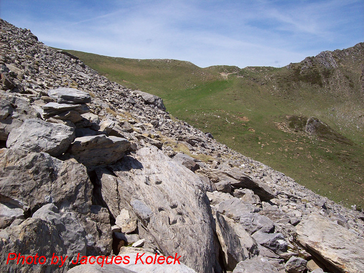
We’re looking to the west to the Port de Belhay where bm250 is located. Note the small darkgreen hilltop to the right which is visible at Google Earth. That makes it easy to determine a straight line (approx. west-east) from Port de Belhay to this cross somewhere in the rockslide.
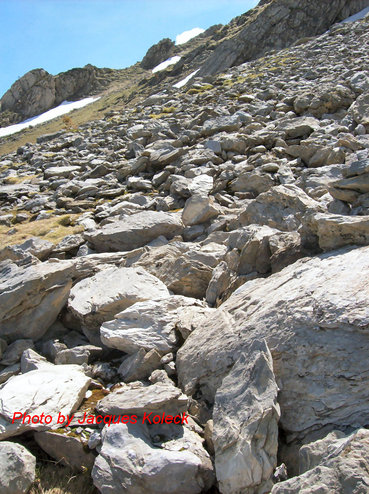
And on this second picture, we are necessarily looking south-east because of the other angle we see the cross but the picture gives no other clue. But the picture Charles sent me, made it possible to draw another line. And where those two lines intersect ……

But first an overview from Google Earth (note: compass direction reversed -> South is up). Remarkable: the yellow borderline (according to GE) is south of the actual bm251. A question for later: where is the official border?
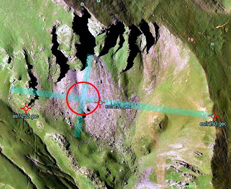
As said before, the crossing of the two straight lines should be the spot of cross 251. According to Google Earth it’s ± 50m to the SE (which is “NW” on this picture) of bm251. Jacques Koleck remembered that the cross was close to the old trail (not the red/white waymarked trail higher up) and on a “considerable” distance from bm251.
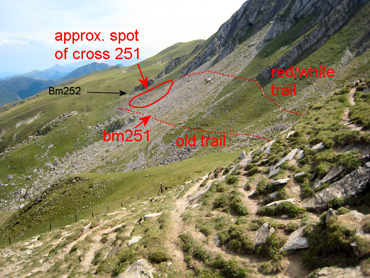
And finally an overview, as seen from Port de Belhay. Having watched this overview, Jacques Koleck added this information: “I think the cross is in the lower part of the circle, above the “old trail” and 20 meters of a large rock well visible on my photo with the Port de Belhay in the background. The cross “looks” east and is probably on a straight line between the stone marker 251 and the cross 252.” The 252-cross is just behind the lower end of the ridge, directly behind the circle.
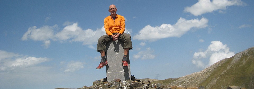
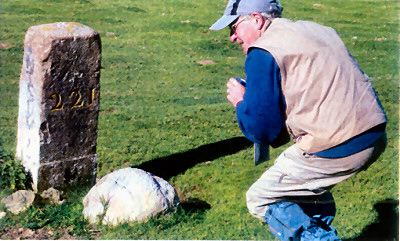
Jacques Koleck: “chasseur de bornes”, age: 77

I was happy and surprised to receive an email of Jacques Koleck, followed by many pictures and detailed information. That provides plenty of fuel for new posts on this blog.
Jacques – living in Pau – started with photographing bordermarkes in 2007. Having begun with bm001, he has now reached the eastern Pyrenees. Having expressed my hope that I can still roam the Pyrenees at his age, he told me that there is also a couple from Biarritz, both 79 years old, still walking along the bordermarkers!
Read about Jacques and his passion in this article.

(Bibliographic data:
Chasseur de bornes en Pyrénées / André-Jaques Dereix
Journal Sud Ouest – Le Mag – 15 september 2012, pag 36-37)


New update of “The bordermarkes of the Pyrenees”

I’m proud to announce that the first series of GRPdesBF-stages is ready: you can walk from Hendaye to Arnéguy (bm001-196) in 8 days.

Check the update-log

Jean Iglesias still ‘live & kicking’

Found on the internet: a newspaper article on the yearly survey in 2012 of the bordermarkers near Coustouges in the eastern Pyrenees. I have fond memories of the rough and mediterranean landscape south of Coustouges. Dense forests, steep hills and deep canyons. Two of the most difficult bordermarkers to find are located in this area: bm536 and bm542.
I was grafeful to meet the friendly and hospitable Jean Iglesias of Coustouges, a local expert on the bordermarkers. Without his help, I wouldn’t have found those bordermarkers.
And he’s still ‘live & kicking’ as the bordermarker-guide for these surveys. I immediately recognized him in the party of surveyors.

TopoPirineos: a free and detailed map of the Pyrenees

I was surprised to learn from Charles Darrieu that there is an extensive and free hikingmap of the Pyrenees. It’s built to be used it in Garmin-software (Mapsource / Campbase) and on Garmin-gps-devices. You can download it from http://topopirineos.blogspot.fr/

Installing this map-software wasn’t that straightforward (at my computer): in the download-process the two files were renamed and that prevented a proper ‘unzipping’. So: when you have downloaded both files, check of they have the following names: ‘TOPO PIRINEOS 6.1.part1.rar’ and ‘TOPO PIRINEOS 6.1.part2.rar’ (of course without the ‘). If not, rename them. Finally you can ‘unzip’ them with software like Winrar of 7-zip. The unzipping gives a giant .exe-file which does the final installment. In Mapsource or Campbase you can chose this map as map-layer.

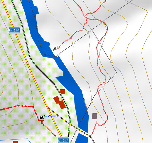
And what does this map offer? Well, every bordermarker is indicated (pillar or cross) but most of all we see many, many trails which we don’t see on the official IGN-maps. You can distinguish between official waymarked trails (and see their names) and other trails. It’s a treasury! An example: the access-routes to bm001:

A shortcut between bm271 and 272: confirmed!

The evidence presented in the previous post has been confirmed by Charles Darrieu. He and his wife Josette tried in 2008 the first part of the shortcut, starting from Col d’Anaye. They didn’t have enough time to climb to the ridge but they found a cairn-waymarked trail uphill.
Moreover: Charles showed how on the Topopirineos-map (see next post) this trail is indicated. And moreover: on Google Earth we can even spot the beginning of it on Col d’Anaye.

I made a kml-file of this connection: esfr-bm271bis-272-connection-on-topopirineos.kml

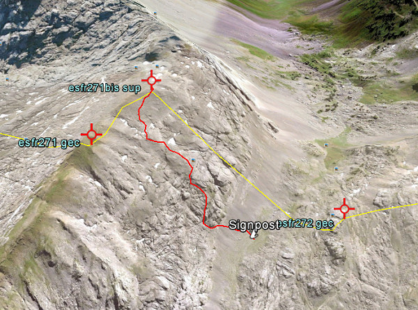
Let’s show some pictures: first an overview of the connection on Google Earth.

And now a view towards Col d’Anaye , approximately on 3/4 of the route from uphill to the Col.

And this picture shows the very beginning, when started from Col d’Anaye. If fact it’s very simple: from the current wooden signpost at Col d’Anaye, climb straight N and soon you will pick up the trail (hito = cairn).


A shorter route between bm271 and 272?

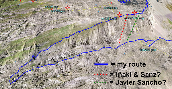
On 20120829 I had to make a large detour to get from bm271 to 272. A shorter descent seemed impossible because of the steepness of the rock-hillside underneath bm271. But I was surprised to read that Iñaki Vigor and Carlos Sanz (see literature) did use a more direct (cairns-waymarked) trail. They also thought it was far too steep. But they found at the saddle between the two hilltops (between bm271 and the former bm271bis) a cairns-trail which took  them without much problems to down below.
Also Javier et María-Jesús Sancho-Esnaola (see this previous post) took a short-cut but their starting point was the saddle east of bm297bis. They talk about following a cairns-trail, descending to the right down a gully (including some rock-scrambling), the route not always being obvious.

In both cases, they must have descended SW. Straight S is – according to the elevation lines – really too steep. Let’s draw it on this Google Earth-capture:

Conclusion: I have to return and check.